Tinqueux night lights from space
Night Light of Tinqueux (Grand Est) from space (France) Src. Average luminocity for 10x10km area is 60.6243% and for 50x50km: 7.9958%.
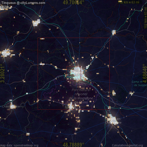
Analysis of Tinqueux night lights 2016
Square area 10x10 km:
 31.55%
90-99
16.44%80-89
1.07%70-79
1.2%60-69
0.53%50-59
3.48%40-49
3.48%30-39
5.35%20-29
10.56%10-19
17.51%0-9
8.82%Square area 50x50 km:
2.14%90-99
1.55%80-89
0.5%70-79
0.54%60-69
0.4%50-59
0.8%40-49
0.89%30-39
0.98%20-29
2.64%10-19
5.05%0-9
84.51%Clear (daylight) street map image can be seen on geolist.org.
Map coordinates:
49° 42' 24.6" North, 3° 16' 48.8" East
49° 15' 0" North, 3° 58' 60" East
48° 47' 20" North, 4° 41' 11.3" East
Some cities around Tinqueux sort by population:
• Reims
3.7 km =2.3 mi,  62°
62°
• Châlons-en-Champagne
43.2 km =26.8 mi,  139°
139°
• Épernay
23.4 km =14.5 mi,  184°
184°
• Rethel
40.1 km =24.9 mi,  43°
43°
• Cormontreuil
6.1 km =3.8 mi,  127°
127°
• Bétheny
6.5 km =4 mi,  53°
53°
• Mourmelon-le-Grand
30.6 km =19 mi,  115°
115°
• Fismes
22.5 km =14 mi,  286°
286°
2972546 (p: 10,197)
Sources (retrieved 2019-11-25):
» Earth at Night: Flat Maps 2012, 2016