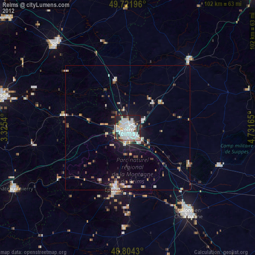
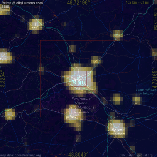
Reims night lights from space
Night Light of Reims (Grand Est) from space (France) Src. Average luminocity for 10x10km area is 70.9358% and for 50x50km: 7.7557%.


Analysis of Reims night lights 2016
Square area 10x10 km:
 38.64%
90-99
18.72%80-89
2.14%70-79
0.67%60-69
0.67%50-59
2.01%40-49
2.41%30-39
9.76%20-29
20.05%10-19
4.95%0-9
0%Square area 50x50 km:
2.07%90-99
1.43%80-89
0.51%70-79
0.55%60-69
0.36%50-59
0.79%40-49
0.85%30-39
1.01%20-29
2.6%10-19
4.73%0-9
85.1%Clear (daylight) street map image can be seen on geolist.org.
Map coordinates:
49° 43' 19.1" North, 3° 19' 31.4" East
49° 15' 54.9" North, 4° 1' 42.7" East
48° 48' 15.5" North, 4° 43' 53.9" East
Some cities around Reims sort by population:
• Châlons-en-Champagne
42.5 km =26.4 mi,  144°
144°
• Épernay
25.5 km =15.8 mi,  191°
191°
• Tinqueux
3.7 km =2.3 mi,  242°
242°
• Rethel
36.6 km =22.7 mi,  42°
42°
• Cormontreuil
5.6 km =3.5 mi,  163°
163°
• Bétheny
2.9 km =1.8 mi, 41°
• Mourmelon-le-Grand
28.5 km =17.7 mi,  121°
121°
• Fismes
25.3 km =15.7 mi,  280°
280°
2984114 (p: 196,565)
Sources (retrieved 2019-11-25):
» NASA, Earths city lights 1995
» NASA city lights 2003
» Earth at Night: Flat Maps 2012, 2016