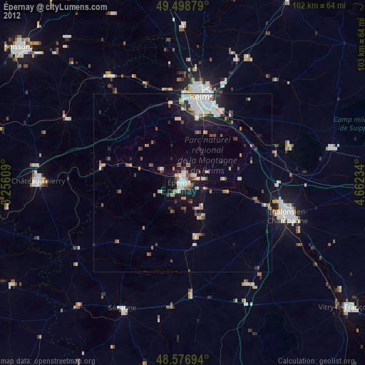
Épernay night lights from space
Night Light of Épernay (Grand Est) from space (France) Src. Average luminocity for 10x10km area is 33.0283% and for 50x50km: 6.6172%.

Analysis of Épernay night lights 2016
Square area 10x10 km:
 6.4%
6.4%90-99
6.85%80-89
3.42%70-79
4.17%60-69
2.83%50-59
0.6%40-49
2.83%30-39
2.53%20-29
7.74%10-19
48.51%0-9
14.14%Square area 50x50 km:
1.51%90-99
1.13%80-89
0.47%70-79
0.54%60-69
0.48%50-59
0.78%40-49
0.74%30-39
0.87%20-29
1.77%10-19
5.17%0-9
86.56%Clear (daylight) street map image can be seen on geolist.org.
Map coordinates:
49° 29' 55.6" North, 3° 15' 21.9" East
49° 2' 24" North, 3° 57' 33.2" East
48° 34' 37" North, 4° 39' 44.4" East
Some cities around Épernay sort by population:
• Reims
25.5 km =15.8 mi,  11°
11°
• Châlons-en-Champagne
31.3 km =19.4 mi,  107°
107°
• Tinqueux
23.4 km =14.5 mi,  4°
4°
• Cormontreuil
20.7 km =12.9 mi,  18°
18°
• Bétheny
28.1 km =17.5 mi, 14°
• Saint-Memmie
32.5 km =20.2 mi, 107°
• Mourmelon-le-Grand
31.2 km =19.4 mi,  70°
70°
• Fismes
35.8 km =22.2 mi,  326°
326°
3020062 (p: 27,082)
Sources (retrieved 2019-11-25):
» Earth at Night: Flat Maps 2012, 2016