Soisy-sous-Montmorency night lights from space
Night Light of Soisy-sous-Montmorency (Île-de-France) from space (France) Src. Average luminocity for 10x10km area is 90.0699% and for 50x50km: 64.78%.
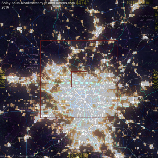
Analysis of Soisy-sous-Montmorency night lights 2016
Square area 10x10 km:
 52.83%
90-99
22.47%80-89
2.68%70-79
4.32%60-69
6.4%50-59
7.14%40-49
2.53%30-39
1.64%20-29
0%10-19
0%0-9
0%Square area 50x50 km:
30.57%90-99
14.94%80-89
4.76%70-79
4.01%60-69
4.83%50-59
4.42%40-49
4.72%30-39
4.27%20-29
6.42%10-19
11.39%0-9
9.67%Clear (daylight) street map image can be seen on geolist.org.
Map coordinates:
49° 26' 50.6" North, 1° 35' 54.3" East
48° 59' 17.3" North, 2° 18' 5.6" East
48° 31' 28.5" North, 3° 0' 16.8" East
Some cities around Soisy-sous-Montmorency sort by population:
• Ermont
3.2 km =2 mi,  273°
273°
• Eaubonne
1.7 km =1.1 mi,  305°
305°
• Deuil-la-Barre
2.3 km =1.4 mi,  124°
124°
• Montmorency
3.1 km =1.9 mi,  89°
89°
• Saint-Gratien
1.9 km =1.2 mi,  212°
212°
• Montmagny
3.7 km =2.3 mi, 116°
• Enghien-les-Bains
2.6 km =1.6 mi,  155°
155°
• Groslay
3.4 km =2.1 mi, 94°
2974385 (p: 17,436)
Sources (retrieved 2019-11-25):
» Earth at Night: Flat Maps 2012, 2016