Deuil-la-Barre night lights from space
Night Light of Deuil-la-Barre (Île-de-France) from space (France) Src. Average luminocity for 10x10km area is 93.4616% and for 50x50km: 65.9207%.
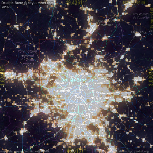
Analysis of Deuil-la-Barre night lights 2016
Square area 10x10 km:
 61.36%
90-99
21.73%80-89
1.56%70-79
3.27%60-69
4.97%50-59
6.11%40-49
0.99%30-39
0%20-29
0%10-19
0%0-9
0%Square area 50x50 km:
31.03%90-99
15.24%80-89
4.82%70-79
4.26%60-69
5.01%50-59
4.51%40-49
4.91%30-39
4.59%20-29
6.06%10-19
10.78%0-9
8.8%Clear (daylight) street map image can be seen on geolist.org.
Map coordinates:
49° 26' 10" North, 1° 37' 26.7" East
48° 58' 36.3" North, 2° 19' 38" East
48° 30' 47.2" North, 3° 1' 49.2" East
Some cities around Deuil-la-Barre sort by population:
• Épinay-sur-Seine
2.7 km =1.7 mi,  198°
198°
• Pierrefitte-sur-Seine
2.7 km =1.7 mi,  113°
113°
• Montmorency
1.7 km =1.1 mi,  42°
42°
• Soisy-sous-Montmorency
2.3 km =1.4 mi,  304°
304°
• Montmagny
1.5 km =0.9 mi,  104°
104°
• Villetaneuse
2.3 km =1.4 mi,  152°
152°
• Enghien-les-Bains
1.4 km =0.9 mi,  214°
214°
• Groslay
1.8 km =1.1 mi,  56°
56°
3021516 (p: 21,560)
Sources (retrieved 2019-11-25):
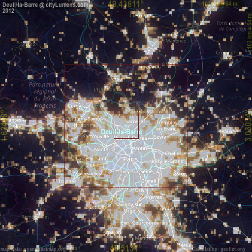
» Earth at Night: Flat Maps 2012, 2016