Saint-Gratien night lights from space
Night Light of Saint-Gratien (Île-de-France) from space (France) Src. Average luminocity for 10x10km area is 95.6165% and for 50x50km: 66.1875%.
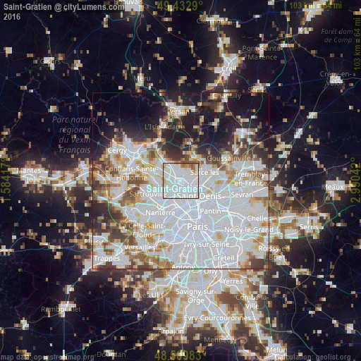
Analysis of Saint-Gratien night lights 2016
Square area 10x10 km:
 64.91%
90-99
23.01%80-89
2.13%70-79
2.84%60-69
4.12%50-59
2.7%40-49
0.28%30-39
0%20-29
0%10-19
0%0-9
0%Square area 50x50 km:
31.27%90-99
15.38%80-89
4.84%70-79
4.23%60-69
4.99%50-59
4.4%40-49
4.82%30-39
4.63%20-29
6.28%10-19
10.57%0-9
8.59%Clear (daylight) street map image can be seen on geolist.org.
Map coordinates:
49° 25' 58.4" North, 1° 35' 3" East
48° 58' 24.6" North, 2° 17' 14.2" East
48° 30' 35.4" North, 2° 59' 25.5" East
Some cities around Saint-Gratien sort by population:
• Argenteuil
4.1 km =2.5 mi,  225°
225°
• Épinay-sur-Seine
3 km =1.9 mi,  137°
137°
• Ermont
2.8 km =1.7 mi,  310°
310°
• Sannois
2.8 km =1.7 mi,  254°
254°
• Eaubonne
2.6 km =1.6 mi,  352°
352°
• Deuil-la-Barre
2.9 km =1.8 mi,  82°
82°
• Soisy-sous-Montmorency
1.9 km =1.2 mi,  32°
32°
• Enghien-les-Bains
2.3 km =1.4 mi,  109°
109°
2979627 (p: 19,737)
Sources (retrieved 2019-11-25):
» Earth at Night: Flat Maps 2012, 2016