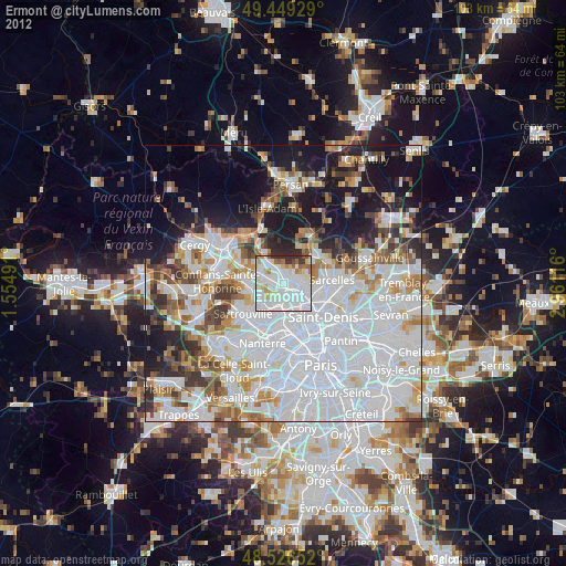
Ermont night lights from space
Night Light of Ermont (Île-de-France) from space (France) Src. Average luminocity for 10x10km area is 89.6875% and for 50x50km: 62.9197%.
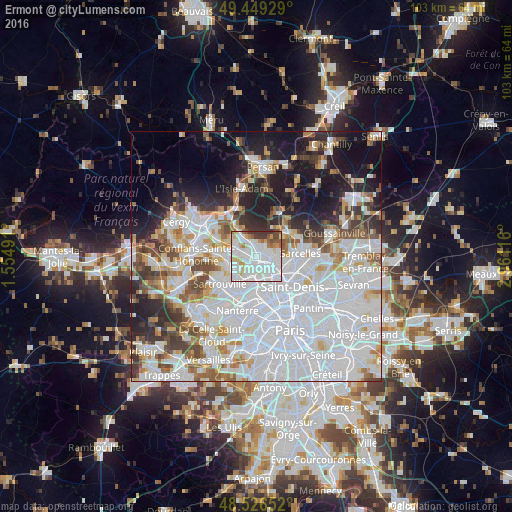
Analysis of Ermont night lights 2016
Square area 10x10 km:
 47.32%
90-99
26.93%80-89
5.65%70-79
5.21%60-69
3.87%50-59
4.02%40-49
2.98%30-39
4.02%20-29
0%10-19
0%0-9
0%Square area 50x50 km:
29.6%90-99
14.05%80-89
4.66%70-79
3.99%60-69
4.71%50-59
4.27%40-49
4.76%30-39
4.45%20-29
6.93%10-19
11.8%0-9
10.77%Clear (daylight) street map image can be seen on geolist.org.
Map coordinates:
49° 26' 57.4" North, 1° 33' 17.7" East
48° 59' 24.1" North, 2° 15' 28.9" East
48° 31' 35.5" North, 2° 57' 40.2" East
Some cities around Ermont sort by population:
• Franconville
2 km =1.2 mi,  247°
247°
• Sannois
2.7 km =1.7 mi,  192°
192°
• Eaubonne
1.9 km =1.2 mi,  66°
66°
• Saint-Gratien
2.8 km =1.7 mi,  130°
130°
• Soisy-sous-Montmorency
3.2 km =2 mi,  93°
93°
• Saint-Leu-la-Forêt
3 km =1.9 mi,  348°
348°
• Le Plessis-Bouchard
2.1 km =1.3 mi,  301°
301°
• Saint-Prix
3 km =1.9 mi,  12°
12°
3019897 (p: 28,117)
Sources (retrieved 2019-11-25):
» Earth at Night: Flat Maps 2012, 2016