Saint-Julien-de-Concelles night lights from space
Night Light of Saint-Julien-de-Concelles (Pays de la Loire) from space (France) Src. Average luminocity for 10x10km area is 16.0357% and for 50x50km: 14.715%.
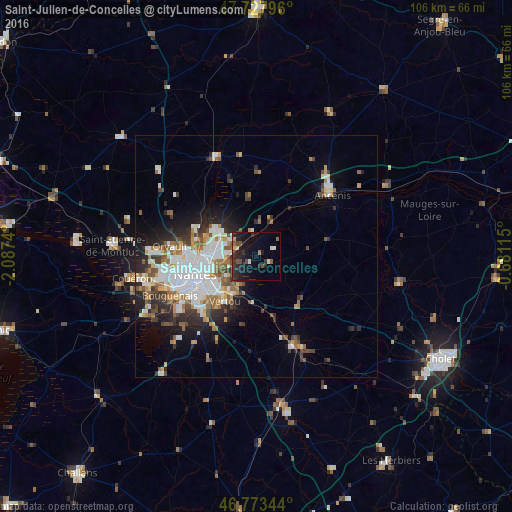
Analysis of Saint-Julien-de-Concelles night lights 2016
Square area 10x10 km:
 1.19%
1.19%90-99
2.08%80-89
0.74%70-79
1.04%60-69
0.6%50-59
2.83%40-49
4.02%30-39
2.68%20-29
10.27%10-19
17.56%0-9
56.99%Square area 50x50 km:
3.77%90-99
2.91%80-89
1.07%70-79
1.39%60-69
1.76%50-59
1.87%40-49
1.82%30-39
1.86%20-29
3.55%10-19
5.58%0-9
74.42%Clear (daylight) street map image can be seen on geolist.org.
Map coordinates:
47° 43' 40.7" North, 2° 5' 14.6" West
47° 15' 10.3" North, 1° 23' 3.4" West
46° 46' 24.4" North, 0° 40' 52.1" West
Some cities around Saint-Julien-de-Concelles sort by population:
• Nantes
13.4 km =8.3 mi,  252°
252°
• Vertou
11.3 km =7 mi,  214°
214°
• Carquefou
9.5 km =5.9 mi,  302°
302°
• Basse-Goulaine
7.8 km =4.8 mi,  233°
233°
• Vallet
13.5 km =8.4 mi,  138°
138°
• Thouaré-sur-Loire
4.5 km =2.8 mi,  293°
293°
• Le Loroux-Bottereau
3.1 km =1.9 mi,  122°
122°
• Haute-Goulaine
6.9 km =4.3 mi, 209°
2979109 (p: 6,758)
Sources (retrieved 2019-11-25):
» Earth at Night: Flat Maps 2012, 2016