Thouaré-sur-Loire night lights from space
Night Light of Thouaré-sur-Loire (Pays de la Loire) from space (France) Src. Average luminocity for 10x10km area is 43.8884% and for 50x50km: 15.4271%.
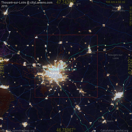
Analysis of Thouaré-sur-Loire night lights 2016
Square area 10x10 km:
 10.12%
90-99
12.65%80-89
2.38%70-79
4.61%60-69
4.91%50-59
5.8%40-49
5.51%30-39
3.87%20-29
10.12%10-19
17.56%0-9
22.47%Square area 50x50 km:
3.81%90-99
3%80-89
1.15%70-79
1.5%60-69
1.89%50-59
1.94%40-49
1.94%30-39
1.89%20-29
3.57%10-19
6.78%0-9
72.53%Clear (daylight) street map image can be seen on geolist.org.
Map coordinates:
47° 44' 38" North, 2° 8' 29.3" West
47° 16' 8.1" North, 1° 26' 18" West
46° 47' 22.8" North, 0° 44' 6.8" West
Some cities around Thouaré-sur-Loire sort by population:
• Saint-Sébastien-sur-Loire
8.4 km =5.2 mi,  215°
215°
• La Chapelle-sur-Erdre
9.2 km =5.7 mi,  289°
289°
• Carquefou
5.1 km =3.2 mi,  309°
309°
• Sainte-Luce-sur-Loire
3.9 km =2.4 mi,  244°
244°
• Basse-Goulaine
6.7 km =4.2 mi,  199°
199°
• Saint-Julien-de-Concelles
4.5 km =2.8 mi,  113°
113°
• Le Loroux-Bottereau
7.6 km =4.7 mi,  117°
117°
• Haute-Goulaine
7.8 km =4.8 mi,  175°
175°
2972696 (p: 7,172)
Sources (retrieved 2019-11-25):
» Earth at Night: Flat Maps 2012, 2016