Argenteuil night lights from space
Night Light of Argenteuil (Île-de-France) from space (France) Src. Average luminocity for 10x10km area is 98.6591% and for 50x50km: 67.9093%.
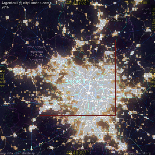
Analysis of Argenteuil night lights 2016
Square area 10x10 km:
 73.44%
90-99
22.3%80-89
3.13%70-79
1.14%60-69
0%50-59
0%40-49
0%30-39
0%20-29
0%10-19
0%0-9
0%Square area 50x50 km:
31.94%90-99
15.72%80-89
4.98%70-79
4.47%60-69
5.05%50-59
4.57%40-49
5.37%30-39
5.14%20-29
6.96%10-19
9.34%0-9
6.46%Clear (daylight) street map image can be seen on geolist.org.
Map coordinates:
49° 24' 27.1" North, 1° 32' 39.6" East
48° 56' 52.4" North, 2° 14' 50.8" East
48° 29' 2.3" North, 2° 57' 2.1" East
Some cities around Argenteuil sort by population:
• Colombes
3.3 km =2.1 mi,  171°
171°
• Sartrouville
4.1 km =2.5 mi,  270°
270°
• Franconville
4.1 km =2.5 mi,  345°
345°
• Bezons
3.6 km =2.2 mi,  223°
223°
• Sannois
2.1 km =1.3 mi,  5°
5°
• Bois-Colombes
3.8 km =2.4 mi,  147°
147°
• Cormeilles-en-Parisis
4 km =2.5 mi,  309°
309°
• Saint-Gratien
4.1 km =2.5 mi,  45°
45°
3037044 (p: 101,475)
Sources (retrieved 2019-11-25):
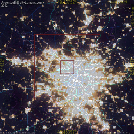
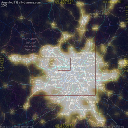
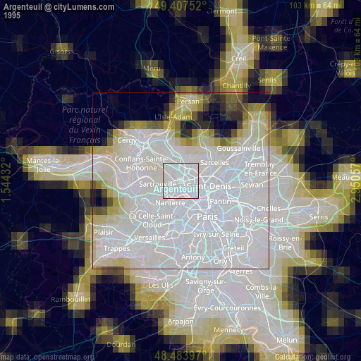
» NASA, Earths city lights 1995
» NASA city lights 2003
» Earth at Night: Flat Maps 2012, 2016