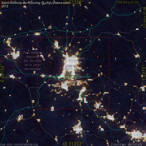
Saint-Étienne-du-Rouvray night lights from space
Night Light of Saint-Étienne-du-Rouvray (Normandy) from space (France) Src. Average luminocity for 10x10km area is 64.8663% and for 50x50km: 16.4873%.
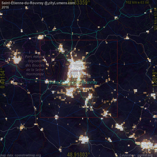
Analysis of Saint-Étienne-du-Rouvray night lights 2016
Square area 10x10 km:
 22.06%
90-99
14.17%80-89
4.55%70-79
5.48%60-69
3.34%50-59
7.22%40-49
16.31%30-39
14.44%20-29
10.7%10-19
1.74%0-9
0%Square area 50x50 km:
3.63%90-99
3.17%80-89
1.02%70-79
1.44%60-69
1.57%50-59
1.95%40-49
2.34%30-39
2.92%20-29
4.6%10-19
9.34%0-9
68.02%Clear (daylight) street map image can be seen on geolist.org.
Map coordinates:
49° 50' 0.9" North, 0° 24' 5.5" East
49° 22' 40.6" North, 1° 6' 16.8" East
48° 55' 4.9" North, 1° 48' 28.1" East
Some cities around Saint-Étienne-du-Rouvray sort by population:
• Rouen
7.3 km =4.5 mi,  356°
356°
• Sotteville-lès-Rouen
3.7 km =2.3 mi,  343°
343°
• Le Grand-Quevilly
5 km =3.1 mi,  300°
300°
• Le Petit-Quevilly
5 km =3.1 mi,  321°
321°
• Oissel
5 km =3.1 mi,  188°
188°
• Grand-Couronne
7.5 km =4.7 mi,  250°
250°
• Petit-Couronne
6.4 km =4 mi,  275°
275°
• Le Mesnil-Esnard
4.9 km =3 mi,  36°
36°
2980236 (p: 28,953)
Sources (retrieved 2019-11-25):
» Earth at Night: Flat Maps 2012, 2016