Moissy-Cramayel night lights from space
Night Light of Moissy-Cramayel (Île-de-France) from space (France) Src. Average luminocity for 10x10km area is 58.3631% and for 50x50km: 40.3846%.
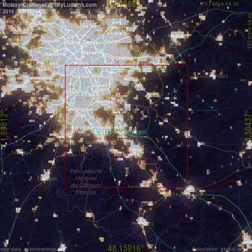
Analysis of Moissy-Cramayel night lights 2016
Square area 10x10 km:
 14.14%
90-99
16.67%80-89
5.36%70-79
6.99%60-69
5.21%50-59
3.27%40-49
5.36%30-39
15.03%20-29
17.56%10-19
10.12%0-9
0.3%Square area 50x50 km:
16.28%90-99
9.72%80-89
2.58%70-79
2.94%60-69
3.23%50-59
2.52%40-49
3.55%30-39
4.23%20-29
5.5%10-19
10.04%0-9
39.4%Clear (daylight) street map image can be seen on geolist.org.
Map coordinates:
49° 5' 19.2" North, 1° 53' 53.2" East
48° 37' 33.8" North, 2° 36' 4.5" East
48° 9' 33" North, 3° 18' 15.7" East
Some cities around Moissy-Cramayel sort by population:
• Savigny-le-Temple
5.9 km =3.7 mi,  193°
193°
• Combs-la-Ville
4.9 km =3 mi,  331°
331°
• Brie-Comte-Robert
7.4 km =4.6 mi,  5°
5°
• Vert-Saint-Denis
6.6 km =4.1 mi,  167°
167°
• Quincy-sous-Sénart
7.2 km =4.5 mi,  316°
316°
• Cesson
7.1 km =4.4 mi,  175°
175°
• Lieusaint
4 km =2.5 mi,  283°
283°
• Nandy
5.6 km =3.5 mi,  210°
210°
2993572 (p: 16,259)
Sources (retrieved 2019-11-25):
» Earth at Night: Flat Maps 2012, 2016