Combs-la-Ville night lights from space
Night Light of Combs-la-Ville (Île-de-France) from space (France) Src. Average luminocity for 10x10km area is 68.0446% and for 50x50km: 50.0331%.
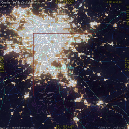
Analysis of Combs-la-Ville night lights 2016
Square area 10x10 km:
 17.86%
90-99
20.09%80-89
5.21%70-79
5.8%60-69
10.57%50-59
4.61%40-49
15.77%30-39
7.89%20-29
11.76%10-19
0.45%0-9
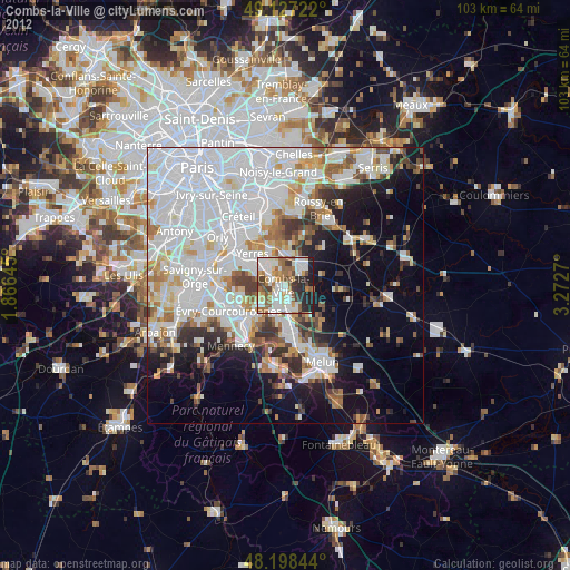
0%Square area 50x50 km:
21.95%90-99
12.2%80-89
3.21%70-79
3.48%60-69
3.85%50-59
3.03%40-49
3.82%30-39
4.36%20-29
5.72%10-19
9.2%0-9
29.18%Clear (daylight) street map image can be seen on geolist.org.
Map coordinates:
49° 7' 38" North, 1° 51' 59.2" East
48° 39' 53.9" North, 2° 34' 10.5" East
48° 11' 54.4" North, 3° 16' 21.7" East
Some cities around Combs-la-Ville sort by population:
• Brunoy
6.5 km =4 mi,  299°
299°
• Moissy-Cramayel
4.9 km =3 mi,  151°
151°
• Brie-Comte-Robert
4.3 km =2.7 mi,  44°
44°
• Épinay-sous-Sénart
5.1 km =3.2 mi, 302°
• Villecresnes
6.5 km =4 mi,  340°
340°
• Quincy-sous-Sénart
2.7 km =1.7 mi,  288°
288°
• Lieusaint
3.7 km =2.3 mi,  205°
205°
• Boussy-Saint-Antoine
4.1 km =2.5 mi,  315°
315°
3024107 (p: 22,322)
Sources (retrieved 2019-11-25):
» Earth at Night: Flat Maps 2012, 2016