Mende night lights from space
Night Light of Mende (Occitanie) from space (France) Src. Average luminocity for 10x10km area is 12.8698% and for 50x50km: 1.2554%.
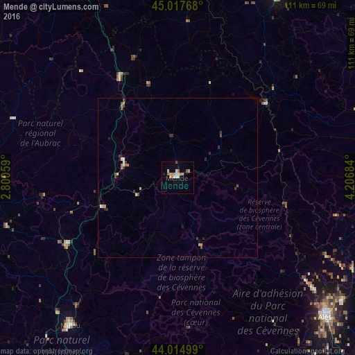
Analysis of Mende night lights 2016
Square area 10x10 km:
 1.27%
1.27%90-99
2.22%80-89
2.7%70-79
2.7%60-69
2.22%50-59
0.63%40-49
0%30-39
0%20-29
0.79%10-19
1.75%0-9
85.71%Square area 50x50 km:
0.08%90-99
0.17%80-89
0.21%70-79
0.17%60-69
0.22%50-59
0.17%40-49
0.1%30-39
0.23%20-29
0.22%10-19
0.24%0-9
98.2%Clear (daylight) street map image can be seen on geolist.org.
Map coordinates:
45° 1' 3.6" North, 2° 48' 2.1" East
44° 31' 6.6" North, 3° 30' 13.4" East
44° 0' 54" North, 4° 12' 24.6" East
Some cities around Mende sort by population:
• Alès
63.4 km =39.4 mi,  133°
133°
• Rodez
76.1 km =47.3 mi,  255°
255°
• Millau
57.8 km =35.9 mi,  215°
215°
• Le Puy-en-Velay
65.7 km =40.8 mi,  27°
27°
• Aubenas
71.1 km =44.2 mi,  80°
80°
• Saint-Flour
65.8 km =40.9 mi,  330°
330°
• Saint-Christol-lès-Alès
66.5 km =41.3 mi,  136°
136°
• Marvejols
17.3 km =10.7 mi,  283°
283°
2994617 (p: 14,837)
Sources (retrieved 2019-11-25):
» Earth at Night: Flat Maps 2012, 2016