Le Puy-en-Velay night lights from space
Night Light of Le Puy-en-Velay (Auvergne-Rhône-Alpes) from space (France) Src. Average luminocity for 10x10km area is 22.3045% and for 50x50km: 1.528%.
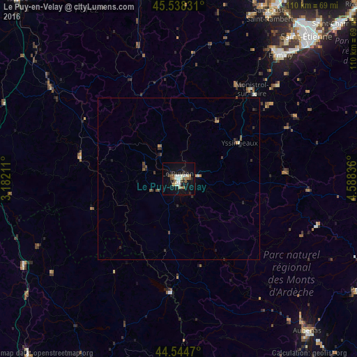
Analysis of Le Puy-en-Velay night lights 2016
Square area 10x10 km:
 2.12%
2.12%90-99
6.52%80-89
1.67%70-79
0.91%60-69
3.79%50-59
2.27%40-49
2.73%30-39
0.61%20-29
4.39%10-19
21.82%0-9
53.18%Square area 50x50 km:
0.09%90-99
0.3%80-89
0.07%70-79
0.11%60-69
0.23%50-59
0.27%40-49
0.27%30-39
0.26%20-29
0.37%10-19
1.07%0-9
96.97%Clear (daylight) street map image can be seen on geolist.org.
Map coordinates:
45° 32' 17.9" North, 3° 10' 55.6" East
45° 2' 37.2" North, 3° 53' 6.8" East
44° 32' 40.9" North, 4° 35' 18.1" East
Some cities around Le Puy-en-Velay sort by population:
• Firminy
49.8 km =30.9 mi,  39°
39°
• Le Chambon-Feugerolles
51.6 km =32.1 mi, 41°
• Unieux
50.2 km =31.2 mi, 37°
• Monistrol-sur-Loire
35.7 km =22.2 mi, 39°
• Brioude
48.1 km =29.9 mi,  305°
305°
• Yssingeaux
21.7 km =13.5 mi,  59°
59°
• Sainte-Sigolène
35.2 km =21.9 mi,  50°
50°
• Aurec-sur-Loire
43.9 km =27.3 mi,  34°
34°
3002465 (p: 22,718)
Sources (retrieved 2019-11-25):
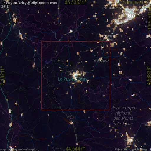
» Earth at Night: Flat Maps 2012, 2016