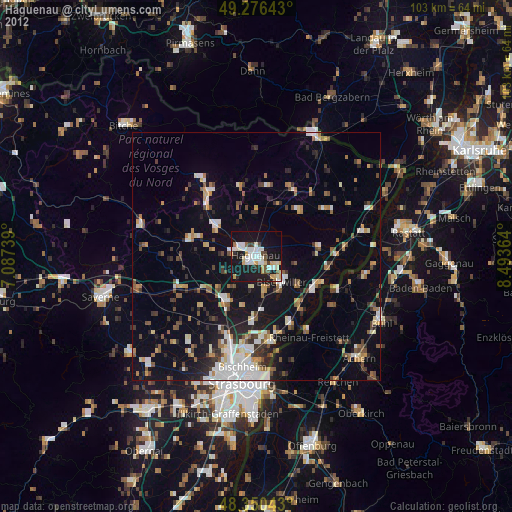
Haguenau night lights from space
Night Light of Haguenau (Grand Est) from space (France) Src. Average luminocity for 10x10km area is 36.7685% and for 50x50km: 14.9715%.
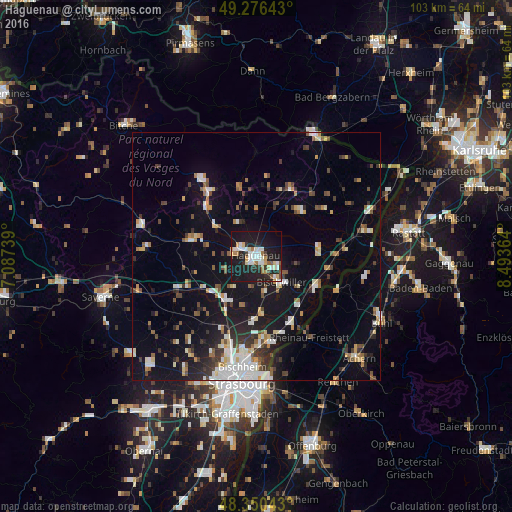
Analysis of Haguenau night lights 2016
Square area 10x10 km:
 7.67%
7.67%90-99
7.95%80-89
4.55%70-79
2.27%60-69
4.26%50-59
2.13%40-49
1.85%30-39
2.7%20-29
12.93%10-19
47.3%0-9
6.39%Square area 50x50 km:
2.38%90-99
2.52%80-89
1.44%70-79
1.26%60-69
1.34%50-59
1.68%40-49
1.98%30-39
2.06%20-29
2.95%10-19
13%0-9
69.4%Clear (daylight) street map image can be seen on geolist.org.
Map coordinates:
49° 16' 35.1" North, 7° 5' 14.6" East
48° 48' 56.1" North, 7° 47' 25.8" East
48° 21' 1.5" North, 8° 29' 37.1" East
Some cities around Haguenau sort by population:
• Bischwiller
7 km =4.3 mi,  138°
138°
• Rheinau, DE
19.8 km =12.3 mi,  147°
147°
• Brumath
10.8 km =6.7 mi,  212°
212°
• La Wantzenau
17.8 km =11.1 mi,  170°
170°
• Vendenheim
17.3 km =10.7 mi,  200°
200°
• Reichshoffen
15.9 km =9.9 mi,  324°
324°
• Reichstett
18.8 km =11.7 mi,  188°
188°
• Lichtenau, DE
18.6 km =11.6 mi,  122°
122°
3014078 (p: 38,721)
Sources (retrieved 2019-11-25):
» Earth at Night: Flat Maps 2012, 2016