La Wantzenau night lights from space
Night Light of La Wantzenau (Grand Est) from space (France) Src. Average luminocity for 10x10km area is 35.8289% and for 50x50km: 22.1844%.
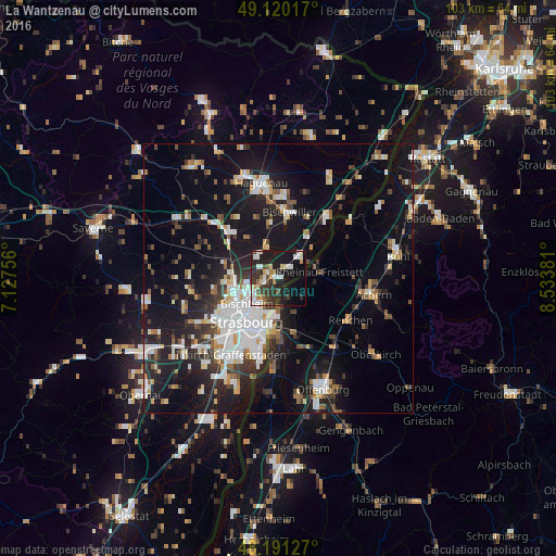
Analysis of La Wantzenau night lights 2016
Square area 10x10 km:
 6.4%
6.4%90-99
7.29%80-89
4.32%70-79
2.83%60-69
3.13%50-59
2.53%40-49
2.83%30-39
9.08%20-29
14.43%10-19
30.06%0-9
17.11%Square area 50x50 km:
4.72%90-99
4.23%80-89
1.82%70-79
1.62%60-69
1.92%50-59
2.1%40-49
2.29%30-39
3.24%20-29
5.97%10-19
19.8%0-9
52.31%Clear (daylight) street map image can be seen on geolist.org.
Map coordinates:
49° 7' 12.6" North, 7° 7' 39.2" East
48° 39' 28.3" North, 7° 49' 50.4" East
48° 11' 28.6" North, 8° 32' 1.7" East
Some cities around La Wantzenau sort by population:
• Schiltigheim
8.2 km =5.1 mi,  226°
226°
• Bischheim
7.3 km =4.5 mi, 230°
• Rheinau, DE
7.8 km =4.8 mi,  83°
83°
• Hœnheim
6.8 km =4.2 mi, 234°
• Souffelweyersheim
7 km =4.3 mi,  249°
249°
• Vendenheim
9 km =5.6 mi,  278°
278°
• Mundolsheim
8.8 km =5.5 mi,  258°
258°
• Reichstett
5.7 km =3.5 mi, 259°
3005422 (p: 5,765)
Sources (retrieved 2019-11-25):
» Earth at Night: Flat Maps 2012, 2016