Grenoble night lights from space
Night Light of Grenoble (Auvergne-Rhône-Alpes) from space (France) Src. Average luminocity for 10x10km area is 78.6045% and for 50x50km: 11.8434%.
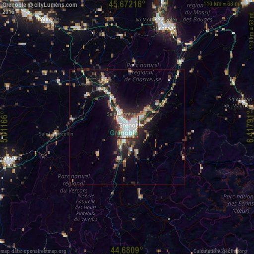
Analysis of Grenoble night lights 2016
Square area 10x10 km:
 36.52%
90-99
23.18%80-89
5.61%70-79
2.58%60-69
4.55%50-59
2.88%40-49
5%30-39
11.52%20-29
8.18%10-19
0%0-9
0%Square area 50x50 km:
2.13%90-99
2.04%80-89
0.95%70-79
1.08%60-69
1.11%50-59
1.71%40-49
1.47%30-39
2.33%20-29
3.63%10-19
8.57%0-9
74.99%Clear (daylight) street map image can be seen on geolist.org.
Map coordinates:
45° 40' 19.8" North, 5° 0' 42" East
45° 10' 43.3" North, 5° 42' 53.2" East
44° 40' 51.2" North, 6° 25' 4.5" East
Some cities around Grenoble sort by population:
• Saint-Martin-d’Hères
3.8 km =2.4 mi,  89°
89°
• Échirolles
3.6 km =2.2 mi,  180°
180°
• Fontaine
2.6 km =1.6 mi,  306°
306°
• Seyssinet-Pariset
1.7 km =1.1 mi,  262°
262°
• Eybens
4.4 km =2.7 mi,  141°
141°
• Seyssins
2.9 km =1.8 mi,  230°
230°
• La Tronche
3.8 km =2.4 mi,  40°
40°
• Saint-Martin-le-Vinoux
2.7 km =1.7 mi,  2°
2°
3014728 (p: 158,552)
Sources (retrieved 2019-11-25):
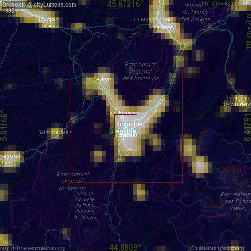
» NASA, Earths city lights 1995
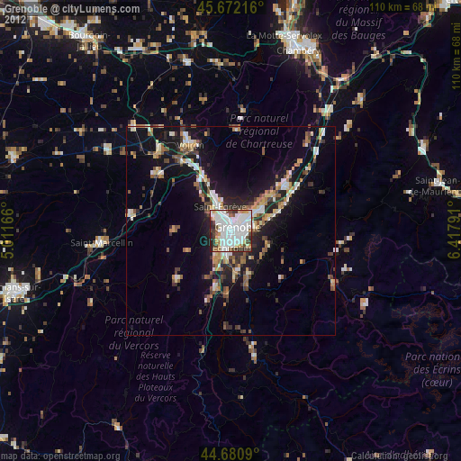
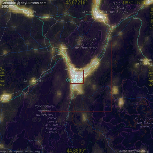
» NASA city lights 2003
» Earth at Night: Flat Maps 2012, 2016