Ézanville night lights from space
Night Light of Ézanville (Île-de-France) from space (France) Src. Average luminocity for 10x10km area is 60.1622% and for 50x50km: 58.1371%.
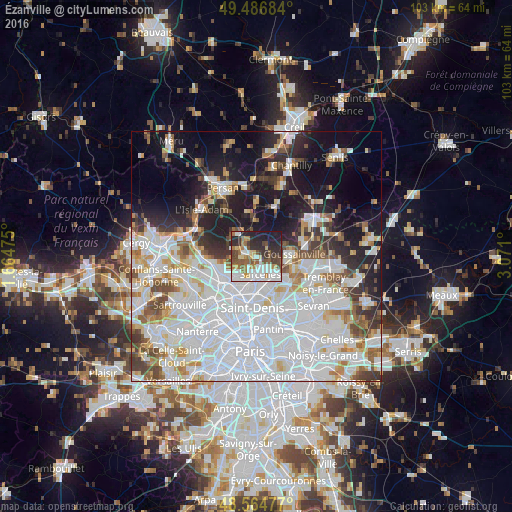
Analysis of Ézanville night lights 2016
Square area 10x10 km:
 16.07%
90-99
13.54%80-89
5.21%70-79
5.06%60-69
9.08%50-59
9.38%40-49
7.74%30-39
8.18%20-29
16.96%10-19
8.78%0-9
0%Square area 50x50 km:
26.21%90-99
13.15%80-89
4.26%70-79
3.86%60-69
4.27%50-59
4.06%40-49
4.23%30-39
4.38%20-29
7.03%10-19
13.93%0-9
14.61%Clear (daylight) street map image can be seen on geolist.org.
Map coordinates:
49° 29' 12.6" North, 1° 39' 53.1" East
49° 1' 40.6" North, 2° 22' 4.3" East
48° 33' 53.2" North, 3° 4' 15.6" East
Some cities around Ézanville sort by population:
• Sarcelles
3.5 km =2.2 mi,  167°
167°
• Villiers-le-Bel
3.1 km =1.9 mi,  133°
133°
• Montmorency
4.8 km =3 mi,  202°
202°
• Domont
3 km =1.9 mi,  269°
269°
• Saint-Brice-sous-Forêt
3.1 km =1.9 mi, 199°
• Groslay
4.9 km =3 mi, 197°
• Écouen
1.4 km =0.9 mi, 126°
• Bouffémont
5.4 km =3.4 mi,  289°
289°
3019175 (p: 8,950)
Sources (retrieved 2019-11-25):
» Earth at Night: Flat Maps 2012, 2016