Épinay-sous-Sénart night lights from space
Night Light of Épinay-sous-Sénart (Île-de-France) from space (France) Src. Average luminocity for 10x10km area is 77.1324% and for 50x50km: 57.3511%.
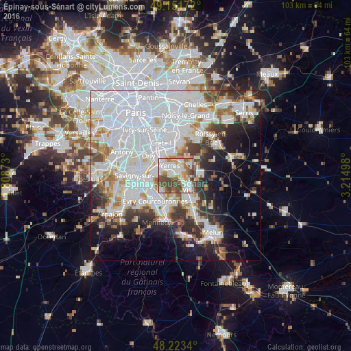
Analysis of Épinay-sous-Sénart night lights 2016
Square area 10x10 km:
 24.26%
90-99
21.88%80-89
7.44%70-79
5.95%60-69
9.82%50-59
8.78%40-49
21.88%30-39
0%20-29
0%10-19
0%0-9
0%Square area 50x50 km:
25.92%90-99
13.67%80-89
3.55%70-79
4.13%60-69
4.59%50-59
3.5%40-49
4.37%30-39
4.75%20-29
6.65%10-19
9.06%0-9
19.8%Clear (daylight) street map image can be seen on geolist.org.
Map coordinates:
49° 9' 6.2" North, 1° 48' 31.4" East
48° 41' 22.9" North, 2° 30' 42.7" East
48° 13' 24.2" North, 3° 12' 53.9" East
Some cities around Épinay-sous-Sénart sort by population:
• Yerres
3.4 km =2.1 mi,  336°
336°
• Brunoy
1.5 km =0.9 mi,  289°
289°
• Montgeron
4.8 km =3 mi, 291°
• Combs-la-Ville
5.1 km =3.2 mi,  122°
122°
• Villecresnes
3.9 km =2.4 mi,  30°
30°
• Crosne
5.2 km =3.2 mi,  309°
309°
• Quincy-sous-Sénart
2.5 km =1.6 mi,  138°
138°
• Boussy-Saint-Antoine
1.4 km =0.9 mi,  83°
83°
3020024 (p: 12,826)
Sources (retrieved 2019-11-25):
» Earth at Night: Flat Maps 2012, 2016