Chauny night lights from space
Night Light of Chauny (Hauts-de-France) from space (France) Src. Average luminocity for 10x10km area is 22.7591% and for 50x50km: 6.6998%.
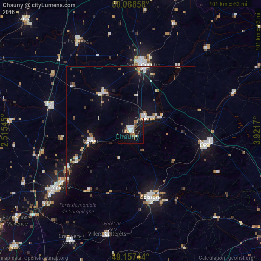
Analysis of Chauny night lights 2016
Square area 10x10 km:
 4.06%
4.06%90-99
3.22%80-89
1.12%70-79
1.82%60-69
5.04%50-59
2.38%40-49
3.08%30-39
1.68%20-29
2.38%10-19
32.07%0-9
43.14%Square area 50x50 km:
1.04%90-99
1.1%80-89
0.51%70-79
0.66%60-69
0.79%50-59
0.75%40-49
0.61%30-39
0.56%20-29
1.12%10-19
6.96%0-9
85.9%Clear (daylight) street map image can be seen on geolist.org.
Map coordinates:
50° 4' 6.9" North, 2° 30' 55.6" East
49° 36' 54.5" North, 3° 13' 6.9" East
49° 9' 26.8" North, 3° 55' 18.1" East
Some cities around Chauny sort by population:
• Saint-Quentin
26.5 km =16.5 mi,  10°
10°
• Soissons
27 km =16.8 mi,  163°
163°
• Laon
30 km =18.6 mi,  101°
101°
• Tergnier
7.5 km =4.7 mi,  52°
52°
• Noyon
16.1 km =10 mi,  257°
257°
• Ham
18 km =11.2 mi,  324°
324°
• Gauchy
24 km =14.9 mi, 9°
• Thourotte
28.8 km =17.9 mi,  237°
237°
3025860 (p: 13,176)
Sources (retrieved 2019-11-25):
» Earth at Night: Flat Maps 2012, 2016