Tergnier night lights from space
Night Light of Tergnier (Hauts-de-France) from space (France) Src. Average luminocity for 10x10km area is 25.7259% and for 50x50km: 6.925%.
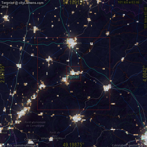
Analysis of Tergnier night lights 2016
Square area 10x10 km:
 5.08%
5.08%90-99
4.68%80-89
2.14%70-79
2.54%60-69
2.94%50-59
1.74%40-49
2.94%30-39
0%20-29
1.6%10-19
44.65%0-9
31.68%Square area 50x50 km:
1.43%90-99
1.42%80-89
0.45%70-79
0.59%60-69
0.71%50-59
0.65%40-49
0.51%30-39
0.48%20-29
0.99%10-19
6.45%0-9
86.32%Clear (daylight) street map image can be seen on geolist.org.
Map coordinates:
50° 6' 32.9" North, 2° 35' 52.6" East
49° 39' 21.9" North, 3° 18' 3.9" East
49° 11' 55.5" North, 4° 0' 15.1" East
Some cities around Tergnier sort by population:
• Saint-Quentin
21.5 km =13.4 mi,  357°
357°
• Soissons
30.6 km =19 mi,  176°
176°
• Laon
25.7 km =16 mi,  113°
113°
• Noyon
23.1 km =14.4 mi,  249°
249°
• Chauny
7.5 km =4.7 mi,  232°
232°
• Guise
35.9 km =22.3 mi,  40°
40°
• Ham
19.3 km =12 mi,  301°
301°
• Gauchy
19.2 km =11.9 mi,  354°
354°
2973146 (p: 15,475)
Sources (retrieved 2019-11-25):
» Earth at Night: Flat Maps 2012, 2016