Castres night lights from space
Night Light of Castres (Occitanie) from space (France) Src. Average luminocity for 10x10km area is 37.9364% and for 50x50km: 4.6444%.
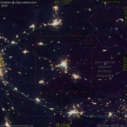
Analysis of Castres night lights 2016
Square area 10x10 km:
 6.36%
6.36%90-99
7.73%80-89
4.39%70-79
4.55%60-69
4.7%50-59
3.94%40-49
3.18%30-39
4.55%20-29
10%10-19
40.91%0-9
9.7%Square area 50x50 km:
0.35%90-99
0.68%80-89
0.5%70-79
0.62%60-69
0.62%50-59
0.65%40-49
0.72%30-39
0.59%20-29
1.14%10-19
2.98%0-9
91.15%Clear (daylight) street map image can be seen on geolist.org.
Map coordinates:
44° 6' 46.3" North, 1° 32' 12.5" East
43° 36' 21.2" North, 2° 14' 23.7" East
43° 5' 40.6" North, 2° 56' 35" East
Some cities around Castres sort by population:
• Albi
36.8 km =22.9 mi,  348°
348°
• Graulhet
26.9 km =16.7 mi,  311°
311°
• Mazamet
16.8 km =10.4 mi,  140°
140°
• Lavaur
35.4 km =22 mi,  286°
286°
• Revel
25.1 km =15.6 mi,  229°
229°
• Aussillon
15.4 km =9.6 mi, 137°
• Saint-Juéry
38.3 km =23.8 mi,  357°
357°
• Labruguière
7.7 km =4.8 mi,  165°
165°
3028263 (p: 47,275)
Sources (retrieved 2019-11-25):
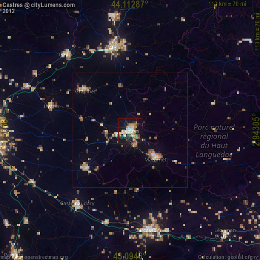
» Earth at Night: Flat Maps 2012, 2016