Aussillon night lights from space
Night Light of Aussillon (Occitanie) from space (France) Src. Average luminocity for 10x10km area is 20.0286% and for 50x50km: 4.1004%.
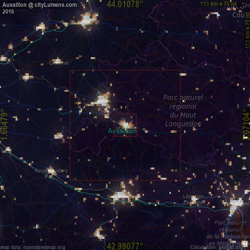
Analysis of Aussillon night lights 2016
Square area 10x10 km:
 0.95%
0.95%90-99
1.59%80-89
2.54%70-79
4.29%60-69
2.06%50-59
2.38%40-49
7.14%30-39
2.54%20-29
2.86%10-19
11.9%0-9
61.75%Square area 50x50 km:
0.3%90-99
0.51%80-89
0.47%70-79
0.48%60-69
0.61%50-59
0.61%40-49
0.65%30-39
0.67%20-29
0.98%10-19
2.92%0-9
91.79%Clear (daylight) street map image can be seen on geolist.org.
Map coordinates:
44° 0' 38.8" North, 1° 39' 53.2" East
43° 30' 10.5" North, 2° 22' 4.5" East
42° 59' 26.8" North, 3° 4' 15.7" East
Some cities around Aussillon sort by population:
• Carcassonne
32.2 km =20 mi,  182°
182°
• Castres
15.4 km =9.6 mi,  317°
317°
• Graulhet
42.3 km =26.3 mi,  313°
313°
• Castelnaudary
39.2 km =24.4 mi,  238°
238°
• Mazamet
1.5 km =0.9 mi,  163°
163°
• Revel
29.7 km =18.5 mi,  260°
260°
• Trèbes
33 km =20.5 mi,  169°
169°
• Labruguière
9.3 km =5.8 mi,  295°
295°
3035991 (p: 7,309)
Sources (retrieved 2019-11-25):
» Earth at Night: Flat Maps 2012, 2016