Blois night lights from space
Night Light of Blois (Centre) from space (France) Src. Average luminocity for 10x10km area is 29.7869% and for 50x50km: 2.7385%.
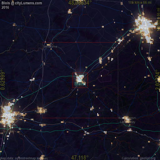
Analysis of Blois night lights 2016
Square area 10x10 km:
 5.97%
5.97%90-99
7.53%80-89
2.84%70-79
2.13%60-69
3.84%50-59
1.7%40-49
2.41%30-39
1.99%20-29
2.7%10-19
35.94%0-9
32.95%Square area 50x50 km:
0.34%90-99
0.46%80-89
0.22%70-79
0.28%60-69
0.36%50-59
0.42%40-49
0.43%30-39
0.34%20-29
0.36%10-19
1.78%0-9
95.01%Clear (daylight) street map image can be seen on geolist.org.
Map coordinates:
48° 3' 58.8" North, 0° 37' 33.6" East
47° 35' 39.6" North, 1° 19' 44.8" East
47° 7' 4.8" North, 2° 1' 56.1" East
Some cities around Blois sort by population:
• Romorantin-Lanthenay
40.5 km =25.2 mi,  128°
128°
• Vendôme
29.6 km =18.4 mi,  318°
318°
• Amboise
33 km =20.5 mi,  232°
232°
• Beaugency
30.4 km =18.9 mi,  47°
47°
• Vineuil
3.7 km =2.3 mi,  108°
108°
• Meung-sur-Loire
38 km =23.6 mi, 46°
• Mer
18.1 km =11.2 mi, 47°
• Château-Renault
31.3 km =19.4 mi,  269°
269°
3032213 (p: 53,660)
Sources (retrieved 2019-11-25):
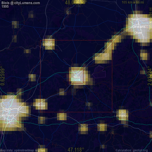
» NASA, Earths city lights 1995
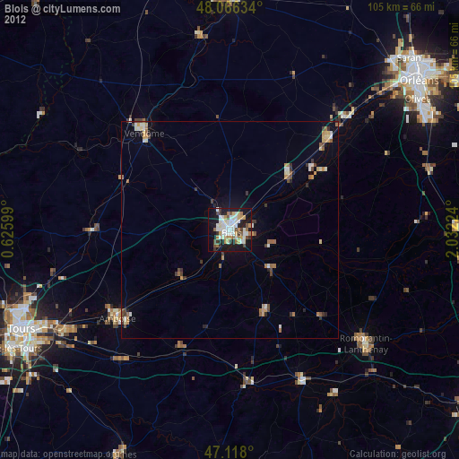
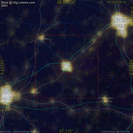
» NASA city lights 2003
» Earth at Night: Flat Maps 2012, 2016