Romorantin-Lanthenay night lights from space
Night Light of Romorantin-Lanthenay (Centre) from space (France) Src. Average luminocity for 10x10km area is 15.2321% and for 50x50km: 2.4035%.
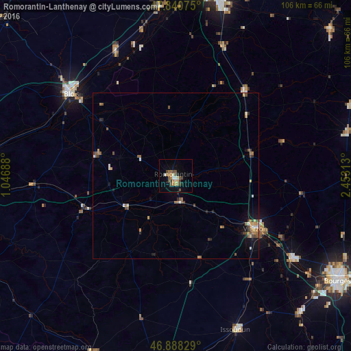
Analysis of Romorantin-Lanthenay night lights 2016
Square area 10x10 km:
 1.19%
1.19%90-99
1.04%80-89
1.64%70-79
2.53%60-69
2.68%50-59
4.32%40-49
2.53%30-39
1.93%20-29
0.89%10-19
6.4%0-9
74.85%Square area 50x50 km:
0.21%90-99
0.22%80-89
0.21%70-79
0.38%60-69
0.43%50-59
0.6%40-49
0.42%30-39
0.29%20-29
0.34%10-19
1.07%0-9
95.83%Clear (daylight) street map image can be seen on geolist.org.
Map coordinates:
47° 50' 26.7" North, 1° 2' 48.8" East
47° 22' 0" North, 1° 45' 0" East
46° 53' 17.8" North, 2° 27' 11.3" East
Some cities around Romorantin-Lanthenay sort by population:
• Blois
40.5 km =25.2 mi,  308°
308°
• Vierzon
28.9 km =18 mi,  123°
123°
• Beaugency
46.9 km =29.1 mi,  348°
348°
• Mehun-sur-Yèvre
43.1 km =26.8 mi,  126°
126°
• La Ferté-Saint-Aubin
41.5 km =25.8 mi,  20°
20°
• Vineuil
37.1 km =23.1 mi, 310°
• Mer
41.9 km =26 mi,  334°
334°
• Salbris
23.6 km =14.7 mi,  74°
74°
2982967 (p: 19,953)
Sources (retrieved 2019-11-25):
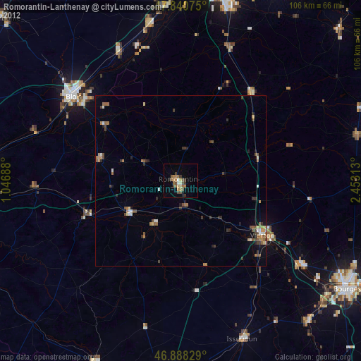
» Earth at Night: Flat Maps 2012, 2016