Mèze night lights from space
Night Light of Mèze (Occitanie) from space (France) Src. Average luminocity for 10x10km area is 22.7968% and for 50x50km: 17.2122%.
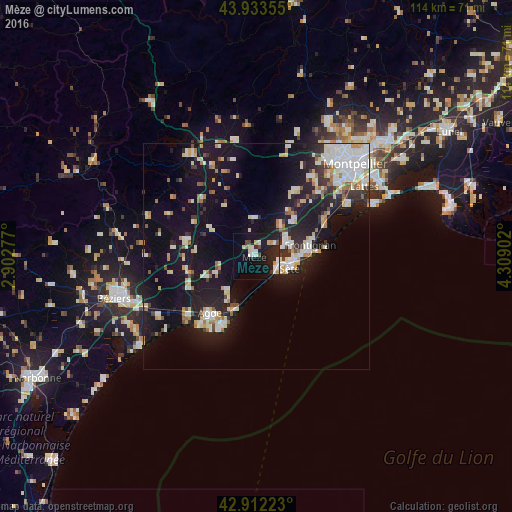
Analysis of Mèze night lights 2016
Square area 10x10 km:
 3.81%
3.81%90-99
4.92%80-89
2.22%70-79
2.22%60-69
0.79%50-59
0.48%40-49
2.54%30-39
0.79%20-29
8.89%10-19
30.63%0-9
42.7%Square area 50x50 km:
3.23%90-99
3.82%80-89
1.71%70-79
1.6%60-69
1.72%50-59
1.15%40-49
1.02%30-39
1.52%20-29
4.61%10-19
16.63%0-9
62.98%Clear (daylight) street map image can be seen on geolist.org.
Map coordinates:
43° 56' 0.8" North, 2° 54' 10" East
43° 25' 30.1" North, 3° 36' 21.2" East
42° 54' 44" North, 4° 18' 32.5" East
Some cities around Mèze sort by population:
• Sète
7.4 km =4.6 mi,  109°
109°
• Agde
16.5 km =10.3 mi,  219°
219°
• Frontignan
12.2 km =7.6 mi,  77°
77°
• Pézenas
15.2 km =9.4 mi,  284°
284°
• Marseillan
9.9 km =6.2 mi, 219°
• Fabrègues
19.6 km =12.2 mi,  44°
44°
• Balaruc-les-Bains
6.1 km =3.8 mi,  72°
72°
• Cournonterral
17.5 km =10.9 mi,  31°
31°
2994043 (p: 8,557)
Sources (retrieved 2019-11-25):
» Earth at Night: Flat Maps 2012, 2016