Achicourt night lights from space
Night Light of Achicourt (Hauts-de-France) from space (France) Src. Average luminocity for 10x10km area is 49.381% and for 50x50km: 22.5957%.
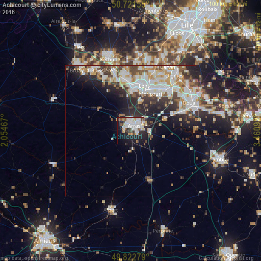
Analysis of Achicourt night lights 2016
Square area 10x10 km:
 16.18%
90-99
12.97%80-89
3.21%70-79
2.54%60-69
4.68%50-59
2.67%40-49
4.95%30-39
5.48%20-29
14.84%10-19
24.2%0-9
8.29%Square area 50x50 km:
5.48%90-99
6.01%80-89
1.93%70-79
2.37%60-69
2.48%50-59
1.85%40-49
2.65%30-39
3.27%20-29
5.9%10-19
7.16%0-9
60.9%Clear (daylight) street map image can be seen on geolist.org.
Map coordinates:
50° 43' 17.6" North, 2° 3' 16.8" East
50° 16' 27.4" North, 2° 45' 28" East
49° 49' 22" North, 3° 27' 39.3" East
Some cities around Achicourt sort by population:
• Arras
2.7 km =1.7 mi,  39°
39°
• Liévin
16.3 km =10.1 mi,  5°
5°
• Avion
16 km =9.9 mi,  18°
18°
• Méricourt
15.9 km =9.9 mi,  27°
27°
• Rouvroy
16.7 km =10.4 mi, 38°
• Saint-Nicolas
3.7 km =2.3 mi, 24°
• Saint-Laurent-Blangy
4.2 km =2.6 mi,  57°
57°
• Dainville
2.4 km =1.5 mi,  288°
288°
3038703 (p: 7,683)
Sources (retrieved 2019-11-25):
» Earth at Night: Flat Maps 2012, 2016