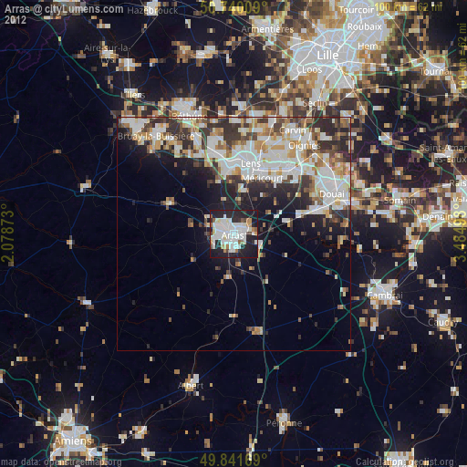
Arras night lights from space
Night Light of Arras (Hauts-de-France) from space (France) Src. Average luminocity for 10x10km area is 57.0535% and for 50x50km: 26.458%.
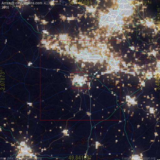
Analysis of Arras night lights 2016
Square area 10x10 km:
 17.11%
90-99
14.84%80-89
4.41%70-79
4.01%60-69
5.75%50-59
3.34%40-49
5.21%30-39
6.68%20-29
31.15%10-19
7.49%0-9
0%Square area 50x50 km:
6.05%90-99
6.94%80-89
2.49%70-79
2.91%60-69
3.08%50-59
2.6%40-49
3.22%30-39
3.92%20-29
6.58%10-19
7.62%0-9
54.59%Clear (daylight) street map image can be seen on geolist.org.
Map coordinates:
50° 44' 24.3" North, 2° 4' 43.4" East
50° 17' 34.8" North, 2° 46' 54.7" East
49° 50' 30.1" North, 3° 29' 5.9" East
Some cities around Arras sort by population:
• Liévin
14.1 km =8.8 mi,  359°
359°
• Avion
13.5 km =8.4 mi,  14°
14°
• Méricourt
13.3 km =8.3 mi,  25°
25°
• Rouvroy
14 km =8.7 mi,  38°
38°
• Achicourt
2.7 km =1.7 mi,  219°
219°
• Saint-Nicolas
1.2 km =0.7 mi,  351°
351°
• Saint-Laurent-Blangy
1.8 km =1.1 mi,  84°
84°
• Dainville
4.2 km =2.6 mi,  251°
251°
3036784 (p: 47,052)
Sources (retrieved 2019-11-25):
» Earth at Night: Flat Maps 2012, 2016