Verín night lights from space
Night Light of Verín (Galicia) from space (Spain) Src. Average luminocity for 10x10km area is 17.246% and for 50x50km: 3.8635%.
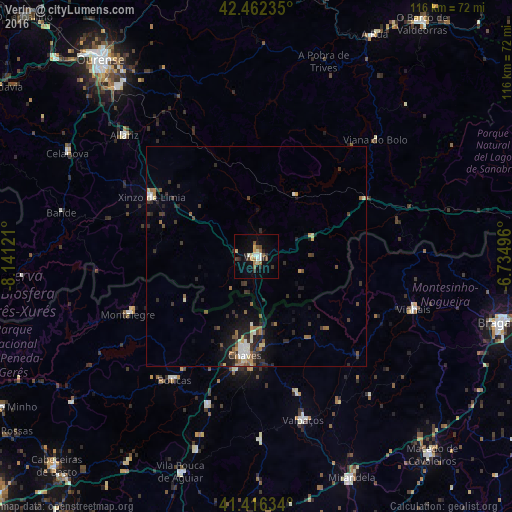
Analysis of Verín night lights 2016
Square area 10x10 km:
 1.59%
1.59%90-99
2.54%80-89
2.22%70-79
1.9%60-69
2.54%50-59
2.7%40-49
1.11%30-39
3.17%20-29
3.33%10-19
7.78%0-9
71.11%Square area 50x50 km:
0.28%90-99
0.54%80-89
0.42%70-79
0.29%60-69
0.58%50-59
0.7%40-49
0.45%30-39
1.01%20-29
1.32%10-19
2.25%0-9
92.16%Clear (daylight) street map image can be seen on geolist.org.
Map coordinates:
42° 27' 44.5" North, 8° 8' 28.4" West
41° 56' 29.4" North, 7° 26' 17.1" West
41° 24' 58.8" North, 6° 44' 5.9" West
Some cities around Verín sort by population:
• Chaves, PT
22.5 km =14 mi,  186°
186°
• Mirandela, PT
54.6 km =33.9 mi,  157°
157°
• Xinzo de Limia
27.3 km =17 mi,  299°
299°
• Vinhais, PT
37.7 km =23.4 mi,  108°
108°
• Celanova
48.7 km =30.3 mi, 298°
• Boticas, PT
33.9 km =21.1 mi,  214°
214°
• Pereiro de Aguiar
53.9 km =33.5 mi,  326°
326°
• Allariz
40.8 km =25.4 mi,  312°
312°
3106086 (p: 14,391)
Sources (retrieved 2019-11-25):
» Earth at Night: Flat Maps 2012, 2016