Mazaricos night lights from space
Night Light of Mazaricos (Galicia) from space (Spain) Src. Average luminocity for 10x10km area is 0.7667% and for 50x50km: 4.7365%.
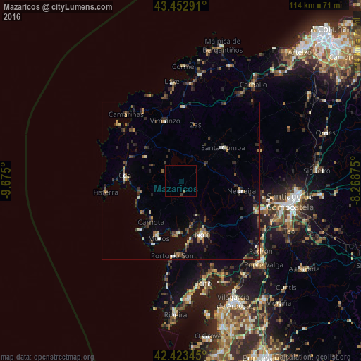
Analysis of Mazaricos night lights 2016
Square area 10x10 km:
 0%
0%90-99
0%80-89
0%70-79
0%60-69
0%50-59
0.63%40-49
0%30-39
0.63%20-29
0%10-19
0.32%0-9
98.41%Square area 50x50 km:
0.17%90-99
0.7%80-89
0.29%70-79
0.45%60-69
0.52%50-59
0.69%40-49
0.97%30-39
1.02%20-29
1.64%10-19
2.83%0-9
90.72%Clear (daylight) street map image can be seen on geolist.org.
Map coordinates:
43° 27' 10.5" North, 9° 40' 30" West
42° 56' 25.2" North, 8° 58' 18.7" West
42° 25' 24.4" North, 8° 16' 7.5" West
Some cities around Mazaricos sort by population:
• Santa Comba
16.8 km =10.4 mi,  52°
52°
• Muros
19.6 km =12.2 mi,  201°
201°
• Porto do Son
24.1 km =15 mi,  186°
186°
• Outes
10.4 km =6.5 mi,  146°
146°
• Cee
17.7 km =11 mi,  275°
275°
• Negreira
19.1 km =11.9 mi,  102°
102°
• Carnota
16.1 km =10 mi,  216°
216°
• Fisterra
24 km =14.9 mi,  260°
260°
3117076 (p: 5,523)
Sources (retrieved 2019-11-25):
» Earth at Night: Flat Maps 2012, 2016