Naja' Šł§ammńĀdńę night lights from space
Night Light of Naja' Šł§ammńĀdńę (Qena) from space (Egypt) Src. Average luminocity for 10x10km area is 88.9504% and for 50x50km: 31.4275%.
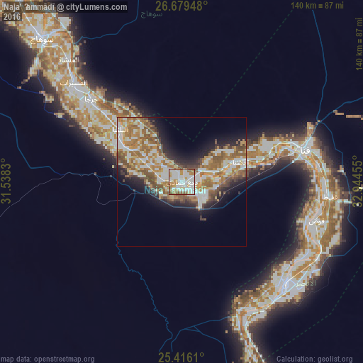

Analysis of Naja' Šł§ammńĀdńę night lights 2016
Square area 10x10 km:
 34.13%
90-99
30.95%80-89
8.93%70-79
10.52%60-69
8.53%50-59
6.75%40-49
0.2%30-39
0%20-29
0%10-19
0%0-9
0%Square area 50x50 km:
6.05%90-99
7.18%80-89
2.48%70-79
5.27%60-69
6.97%50-59
5.23%40-49
3.61%30-39
2.28%20-29
4.45%10-19
8.08%0-9
48.37%Clear (daylight) street map image can be seen on geolist.org.
Map coordinates:
26° 40' 46.1" North, 31° 32' 17.9" East
26° 2' 58.2" North, 32° 14' 29.1" East
25° 24' 58" North, 32° 56' 40.4" East
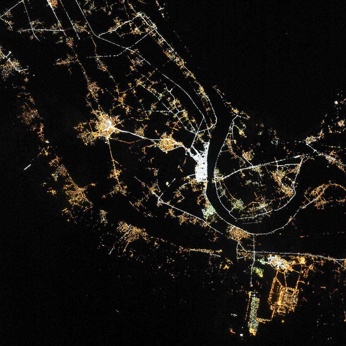
Fantastic image of Naja' Šł§ammńĀdńę from space taken by astronauts [src2], but I don't have information about it's orientation, scale or angle. If necessary, it was rotated manually, so North points approximately to upper direction. Click to zoom in:
Some cities around Naja' Šł§ammńĀdńę sort by population:
• Luxor
55.9 km =34.7 mi,  134°
134°
• QinńĀ
50.1 km =31.1 mi,  75°
75°
• JirjńĀ
47.4 km =29.5 mi,  312°
312°
• Al ManshńĀh
64.5 km =40.1 mi,  317°
317°
• Kousa
54.2 km =33.7 mi,  105°
105°
• DishnńĀ
24.9 km =15.5 mi,  70°
70°
• FarshŇęŇ£
7.8 km =4.8 mi,  274°
274°
• Al BalyanńĀ
31.5 km =19.6 mi, 311°
351434 (p: 41,184)
Sources (retrieved 2019-11-25):
» Earth at Night: Flat Maps 2012, 2016
Src.2: picture by Oleg Kononenko,†Roscosmos, retrieved 2019-11-29