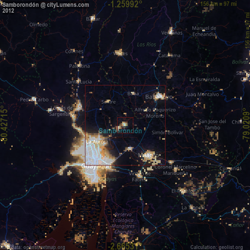
Samborondón night lights from space
Night Light of Samborondón (Guayas) from space (Ecuador) Src. Average luminocity for 10x10km area is 17.0952% and for 50x50km: 21.8714%.
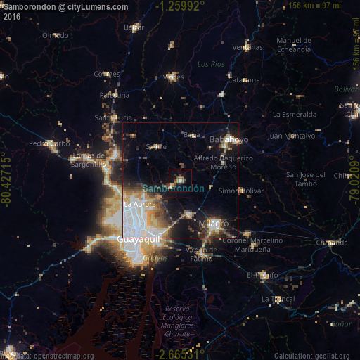
Analysis of Samborondón night lights 2016
Square area 10x10 km:
 1.52%
1.52%90-99
1.08%80-89
1.73%70-79
1.73%60-69
5.19%50-59
2.38%40-49
3.9%30-39
3.9%20-29
0.43%10-19
5.84%0-9
72.29%Square area 50x50 km:
6.5%90-99
3.61%80-89
2.04%70-79
2.28%60-69
2.36%50-59
1.77%40-49
3.5%30-39
3.26%20-29
2.92%10-19
10.07%0-9
61.69%Clear (daylight) street map image can be seen on geolist.org.
Map coordinates:
1° 15' 35.7" South, 80° 25' 37.7" West
1° 57' 45.9" South, 79° 43' 26.5" West
2° 39' 55.1" South, 79° 1' 15.2" West
Some cities around Samborondón sort by population:
• Guayaquil
31.6 km =19.6 mi,  214°
214°
• Eloy Alfaro
27.8 km =17.3 mi, 211°
• Milagro
23.9 km =14.9 mi,  142°
142°
• Babahoyo
27.6 km =17.1 mi,  49°
49°
• El Triunfo
27.2 km =16.9 mi,  276°
276°
• Yaguachi Nuevo
15.3 km =9.5 mi,  167°
167°
• Alfredo Baquerizo Moreno
23.6 km =14.7 mi,  77°
77°
• Palestina
3.1 km =1.9 mi,  21°
21°
3652065 (p: 24,118)
Sources (retrieved 2019-11-25):
» Earth at Night: Flat Maps 2012, 2016