Yaguachi Nuevo night lights from space
Night Light of Yaguachi Nuevo (Guayas) from space (Ecuador) Src. Average luminocity for 10x10km area is 20.3658% and for 50x50km: 25.0402%.
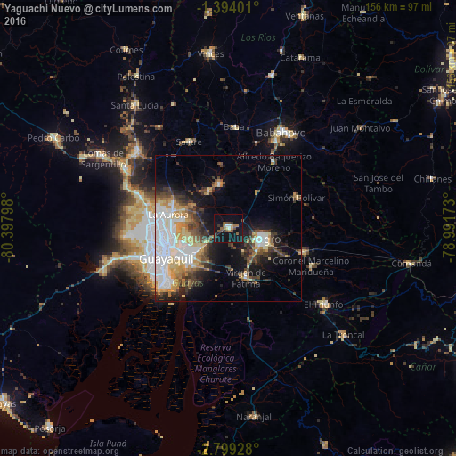
Analysis of Yaguachi Nuevo night lights 2016
Square area 10x10 km:
 1.08%
1.08%90-99
1.52%80-89
1.08%70-79
1.73%60-69
2.81%50-59
6.28%40-49
4.33%30-39
2.6%20-29
2.38%10-19
37.01%0-9
39.18%Square area 50x50 km:
6.61%90-99
4.08%80-89
2.61%70-79
3.12%60-69
3.07%50-59
1.93%40-49
4.02%30-39
4.31%20-29
3.96%10-19
10.59%0-9
55.69%Clear (daylight) street map image can be seen on geolist.org.
Map coordinates:
1° 23' 38.4" South, 80° 23' 52.7" West
2° 5' 48.5" South, 79° 41' 41.5" West
2° 47' 57.4" South, 78° 59' 30.2" West
Some cities around Yaguachi Nuevo sort by population:
• Guayaquil
24 km =14.9 mi,  242°
242°
• Eloy Alfaro
19.9 km =12.4 mi, 243°
• Milagro
11.9 km =7.4 mi,  110°
110°
• Naranjito
26.7 km =16.6 mi, 106°
• Samborondón
15.3 km =9.5 mi,  347°
347°
• Alfredo Baquerizo Moreno
28.2 km =17.5 mi,  44°
44°
• Palestina
17.9 km =11.1 mi, 353°
• Coronel Marcelino Maridueña
31.7 km =19.7 mi, 113°
3650121 (p: 27,947)
Sources (retrieved 2019-11-25):
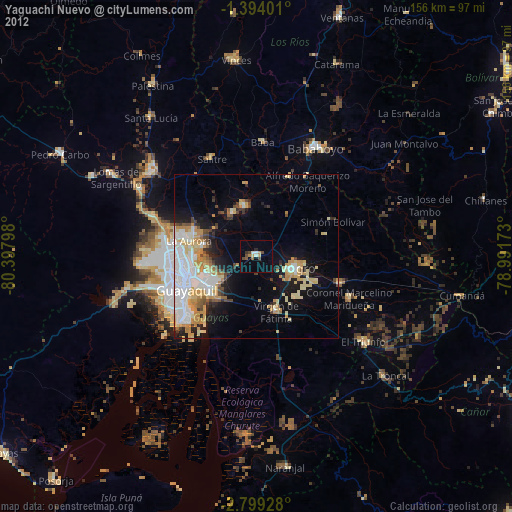
» Earth at Night: Flat Maps 2012, 2016