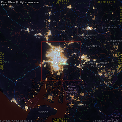
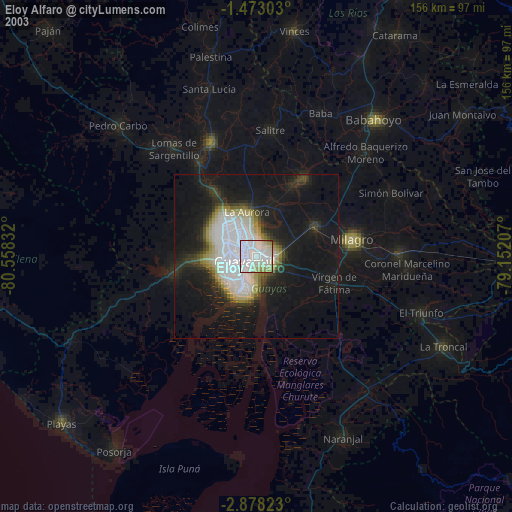
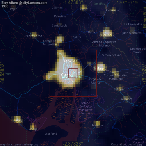
Eloy Alfaro night lights from space
Night Light of Eloy Alfaro (Guayas) from space (Ecuador) Src. Average luminocity for 10x10km area is 95.4524% and for 50x50km: 35.3344%.
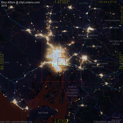
Analysis of Eloy Alfaro night lights 2016
Square area 10x10 km:
 42.64%
90-99
36.58%80-89
16.23%70-79
4.55%60-69
0%50-59
0%40-49
0%30-39
0%20-29
0%10-19
0%0-9
0%Square area 50x50 km:
9.56%90-99
5.67%80-89
5.48%70-79
4.67%60-69
3.97%50-59
3.24%40-49
5.09%30-39
4.85%20-29
5.32%10-19
11.98%0-9
40.18%Clear (daylight) street map image can be seen on geolist.org.
Map coordinates:
1° 28' 22.9" South, 80° 33' 30" West
2° 10' 32.8" South, 79° 51' 18.7" West
2° 52' 41.6" South, 79° 9' 7.5" West
Some cities around Eloy Alfaro sort by population:
• Guayaquil
4.1 km =2.5 mi,  236°
236°
• Milagro
29.4 km =18.3 mi,  80°
80°
• El Triunfo
29.7 km =18.5 mi,  335°
335°
• Yaguachi Nuevo
19.9 km =12.4 mi,  63°
63°
• Samborondón
27.8 km =17.3 mi,  31°
31°
• Santa Lucía
16.1 km =10 mi,  267°
267°
• Palestina
30.8 km =19.1 mi, 30°
• Lomas de Sargentillo
41.2 km =25.6 mi,  322°
322°
3658192 (p: 167,784)
Sources (retrieved 2019-11-25):
» NASA, Earths city lights 1995
» NASA city lights 2003
» Earth at Night: Flat Maps 2012, 2016