Guayaquil night lights from space
Night Light of Guayaquil (Guayas) from space (Ecuador) Src. Average luminocity for 10x10km area is 95.5714% and for 50x50km: 34.2378%.
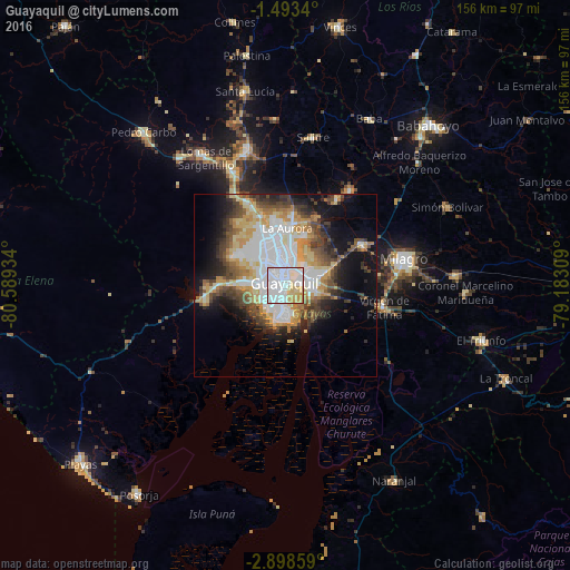
Analysis of Guayaquil night lights 2016
Square area 10x10 km:
 56.28%
90-99
21.86%80-89
16.02%70-79
5.19%60-69
0.65%50-59
0%40-49
0%30-39
0%20-29
0%10-19
0%0-9
0%Square area 50x50 km:
9.52%90-99
5.64%80-89
5.32%70-79
4.56%60-69
3.88%50-59
3.1%40-49
4.73%30-39
4.57%20-29
4.75%10-19
10.42%0-9
43.51%Clear (daylight) street map image can be seen on geolist.org.
Map coordinates:
1° 29' 36.2" South, 80° 35' 21.6" West
2° 11' 46.2" South, 79° 53' 10.4" West
2° 53' 54.9" South, 79° 10' 59.1" West
Some cities around Guayaquil sort by population:
• Eloy Alfaro
4.1 km =2.5 mi,  56°
56°
• Milagro
33.2 km =20.6 mi,  77°
77°
• El Triunfo
30.6 km =19 mi,  342°
342°
• Yaguachi Nuevo
24 km =14.9 mi, 62°
• Samborondón
31.6 km =19.6 mi,  34°
34°
• Santa Lucía
12.7 km =7.9 mi,  276°
276°
• Palestina
34.6 km =21.5 mi, 33°
• Lomas de Sargentillo
41.1 km =25.5 mi,  327°
327°
3657509 (p: 1,952,029)
Sources (retrieved 2019-11-25):
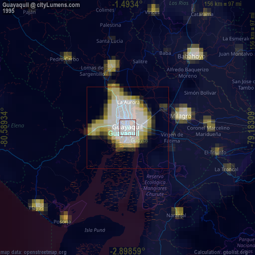
» NASA, Earths city lights 1995
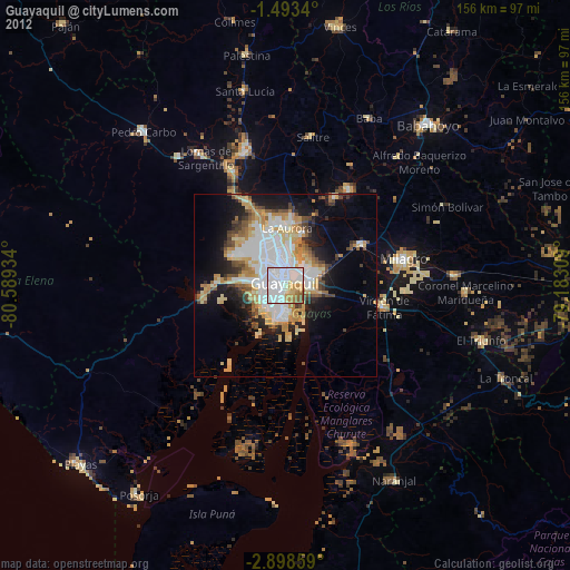
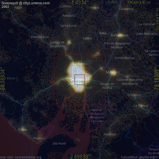
» NASA city lights 2003
» Earth at Night: Flat Maps 2012, 2016