Atuntaqui night lights from space
Night Light of Atuntaqui (Imbabura) from space (Ecuador) Src. Average luminocity for 10x10km area is 52.6883% and for 50x50km: 11.9644%.
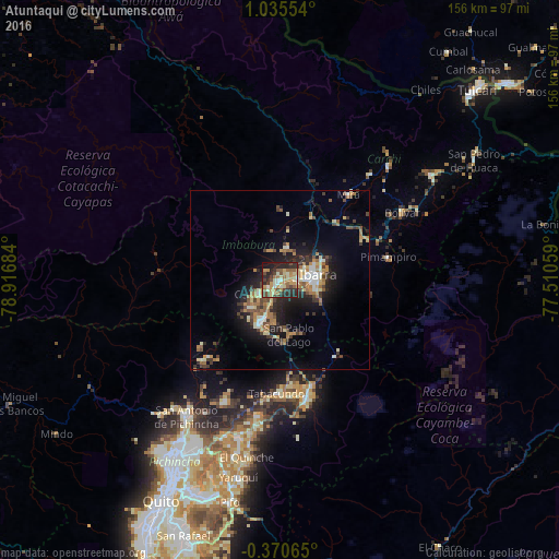
Analysis of Atuntaqui night lights 2016
Square area 10x10 km:
 1.52%
1.52%90-99
10.39%80-89
9.52%70-79
14.72%60-69
7.14%50-59
6.93%40-49
9.74%30-39
7.36%20-29
23.81%10-19
8.66%0-9
0.22%Square area 50x50 km:
0.69%90-99
1.91%80-89
1.52%70-79
1.8%60-69
2.29%50-59
1.29%40-49
2.06%30-39
2.16%20-29
3.53%10-19
7.44%0-9
75.29%Clear (daylight) street map image can be seen on geolist.org.
Map coordinates:
1° 2' 7.9" North, 78° 55' 0.6" West
0° 19' 56.9" North, 78° 12' 49.4" West
0° 22' 14.3" South, 77° 30' 38.1" West
Some cities around Atuntaqui sort by population:
• Quito
71.5 km =44.4 mi,  208°
208°
• Tutamandahostel
66.8 km =41.5 mi, 208°
• Ibarra
10.4 km =6.5 mi,  78°
78°
• Otavalo
12.2 km =7.6 mi, 206°
• Cayambe
33.3 km =20.7 mi,  166°
166°
• San Gabriel
51.5 km =32 mi,  55°
55°
• Cotacachi
6.6 km =4.1 mi,  238°
238°
• Pimampiro
31.1 km =19.3 mi, 77°
3660478 (p: 17,456)
Sources (retrieved 2019-11-25):
» Earth at Night: Flat Maps 2012, 2016