Sidi Moussa night lights from space
Night Light of Sidi Moussa (Blida) from space (Algeria) Src. Average luminocity for 10x10km area is 67.8242% and for 50x50km: 50.0615%.
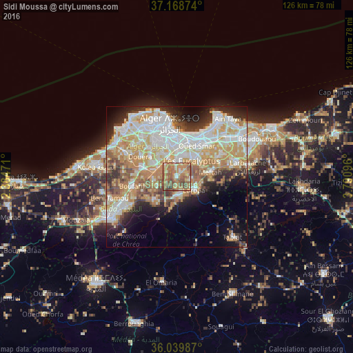
Analysis of Sidi Moussa night lights 2016
Square area 10x10 km:
 3.85%
3.85%90-99
6.96%80-89
11.9%70-79
18.5%60-69
26.92%50-59
21.79%40-49
8.42%30-39
1.65%20-29
0%10-19
0%0-9
0%Square area 50x50 km:
12.35%90-99
11.56%80-89
6.81%70-79
8.99%60-69
8.02%50-59
4.38%40-49
4.11%30-39
4.81%20-29
5.85%10-19
7.55%0-9
25.57%Clear (daylight) street map image can be seen on geolist.org.
Map coordinates:
37° 10' 7.5" North, 2° 23' 5" East
36° 36' 22.9" North, 3° 5' 16.2" East
36° 2' 23.5" North, 3° 47' 27.5" East
Some cities around Sidi Moussa sort by population:
• Baraki
6.7 km =4.2 mi,  6°
6°
• Birkhadem
12.5 km =7.8 mi,  344°
344°
• Larbaâ
7.5 km =4.7 mi,  127°
127°
• Bougara
7.2 km =4.5 mi,  184°
184°
• Meftah
12.1 km =7.5 mi,  82°
82°
• Bouinan
11.9 km =7.4 mi,  225°
225°
• Chebli
7.7 km =4.8 mi,  245°
245°
• Saoula
12.3 km =7.6 mi,  332°
332°
2479966 (p: 57,928)
Sources (retrieved 2019-11-25):
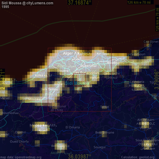
» NASA, Earths city lights 1995
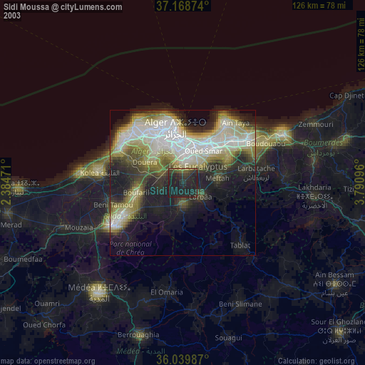
» NASA city lights 2003
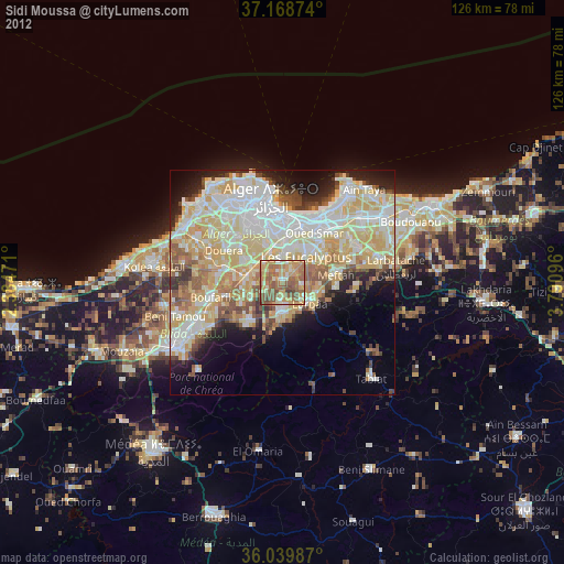
» Earth at Night: Flat Maps 2012, 2016