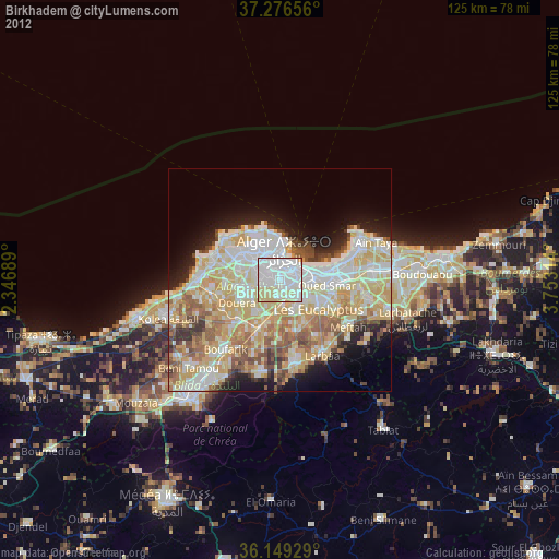
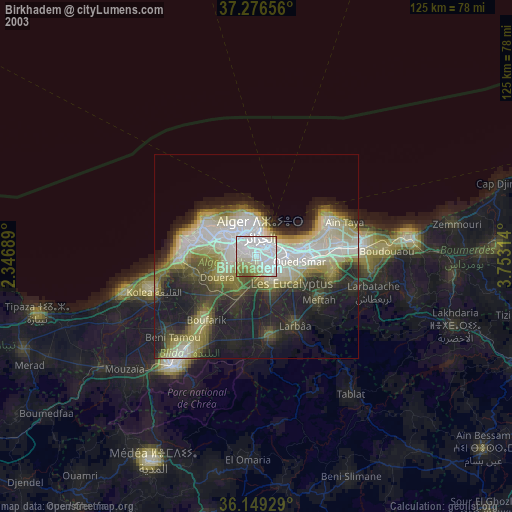
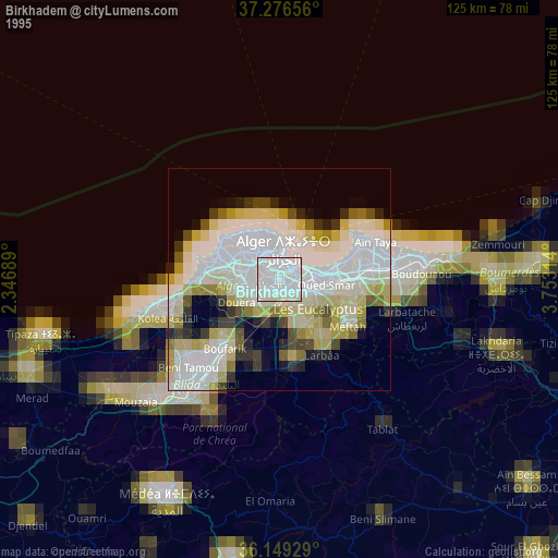
Birkhadem night lights from space
Night Light of Birkhadem (Algiers) from space (Algeria) Src. Average luminocity for 10x10km area is 96.8388% and for 50x50km: 47.0079%.
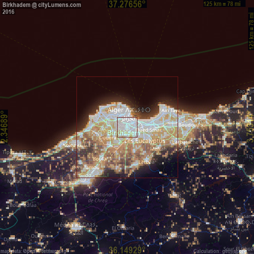
Analysis of Birkhadem night lights 2016
Square area 10x10 km:
 58.61%
90-99
28.39%80-89
9.89%70-79
2.38%60-69
0.73%50-59
0%40-49
0%30-39
0%20-29
0%10-19
0%0-9
0%Square area 50x50 km:
11.64%90-99
10.71%80-89
6.5%70-79
8.33%60-69
7.91%50-59
4.31%40-49
3.89%30-39
4.01%20-29
5.53%10-19
7.15%0-9
30.02%Clear (daylight) street map image can be seen on geolist.org.
Map coordinates:
37° 16' 35.6" North, 2° 20' 48.8" East
36° 42' 54" North, 3° 3' 0.1" East
36° 8' 57.4" North, 3° 45' 11.3" East
Some cities around Birkhadem sort by population:
• Algiers
3.8 km =2.4 mi,  60°
60°
• Bab Ezzouar
11.9 km =7.4 mi,  84°
84°
• Bordj el Kiffan
13.2 km =8.2 mi,  73°
73°
• Baraki
6.8 km =4.2 mi,  142°
142°
• Sidi Moussa
12.5 km =7.8 mi,  164°
164°
• Cheraga
10 km =6.2 mi,  305°
305°
• Douera
10.7 km =6.6 mi,  242°
242°
• Saoula
2.5 km =1.6 mi, 242°
2503847 (p: 71,722)
Sources (retrieved 2019-11-25):
» NASA, Earths city lights 1995
» NASA city lights 2003
» Earth at Night: Flat Maps 2012, 2016