Baraki night lights from space
Night Light of Baraki (Tipaza) from space (Algeria) Src. Average luminocity for 10x10km area is 87.8425% and for 50x50km: 48.4998%.
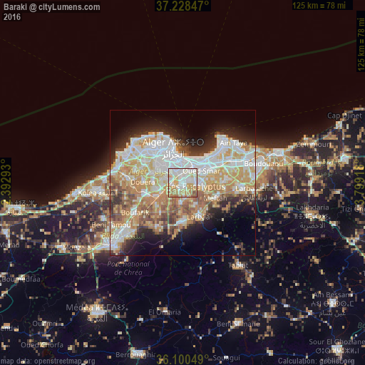
Analysis of Baraki night lights 2016
Square area 10x10 km:
 30.04%
90-99
25.09%80-89
14.47%70-79
19.96%60-69
7.33%50-59
2.38%40-49
0.73%30-39
0%20-29
0%10-19
0%0-9
0%Square area 50x50 km:
12.04%90-99
11.28%80-89
6.61%70-79
8.72%60-69
7.61%50-59
4.08%40-49
3.85%30-39
4.19%20-29
5.89%10-19
8.07%0-9
27.67%Clear (daylight) street map image can be seen on geolist.org.
Map coordinates:
37° 13' 42.5" North, 2° 23' 34.5" East
36° 39' 59.6" North, 3° 5' 45.8" East
36° 6' 1.8" North, 3° 47' 57" East
Some cities around Baraki sort by population:
• Algiers
7.3 km =4.5 mi,  354°
354°
• Bab Ezzouar
10.2 km =6.3 mi,  49°
49°
• Bordj el Kiffan
12.5 km =7.8 mi,  43°
43°
• Birkhadem
6.8 km =4.2 mi,  322°
322°
• Meftah
12.4 km =7.7 mi,  114°
114°
• Sidi Moussa
6.7 km =4.2 mi,  186°
186°
• Dar el Beïda
11.6 km =7.2 mi,  63°
63°
• Saoula
7.6 km =4.7 mi,  303°
303°
2505653 (p: 105,402)
Sources (retrieved 2019-11-25):
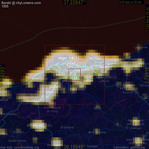
» NASA, Earths city lights 1995
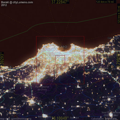
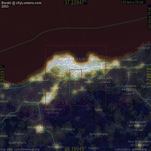
» NASA city lights 2003
» Earth at Night: Flat Maps 2012, 2016