Bouinan night lights from space
Night Light of Bouinan (Blida) from space (Algeria) Src. Average luminocity for 10x10km area is 47.8938% and for 50x50km: 42.1294%.
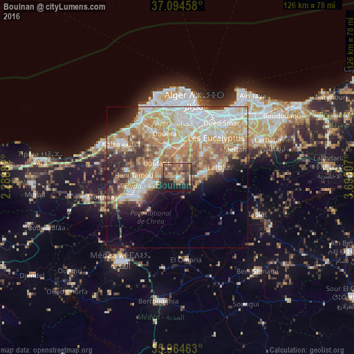
Analysis of Bouinan night lights 2016
Square area 10x10 km:
100  0.92%
0.92%
90-99 5.31%
80-89 4.95%
70-79 7.51%
60-69 15.57%
50-59 12.64%
40-49 17.22%
30-39 5.68%
20-29 11.72%
10-19 18.5%
0-9 0%
0.92%90-99
5.31%80-89
4.95%70-79
7.51%60-69
15.57%50-59
12.64%40-49
17.22%30-39
5.68%20-29
11.72%10-19
18.5%0-9
0%Square area 50x50 km:
100 9.04%
90-99 8.74%
80-89 6.22%
70-79 7.34%
60-69 8.66%
50-59 4.55%
40-49 4.1%
30-39 4.02%
20-29 5.18%
10-19 6.47%
0-9 35.69%
9.04%90-99
8.74%80-89
6.22%70-79
7.34%60-69
8.66%50-59
4.55%40-49
4.1%30-39
4.02%20-29
5.18%10-19
6.47%0-9
35.69%Clear (daylight) street map image can be seen on geolist.org.
Map coordinates:
37° 5' 40.5" North, 2° 17' 19.8" East
36° 31' 54" North, 2° 59' 31" East
35° 57' 52.7" North, 3° 41' 42.3" East
Some cities around Bouinan sort by population:
• Beni Mered
11.7 km =7.3 mi,  265°
265°
• Larbaâ
15 km =9.3 mi,  75°
75°
• Bougara
8 km =5 mi, 81°
• Boufarik
8.5 km =5.3 mi,  303°
303°
• Sidi Moussa
11.9 km =7.4 mi,  45°
45°
• Souma
7.9 km =4.9 mi,  259°
259°
• Douera
16 km =9.9 mi,  344°
344°
• Chebli
5.3 km =3.3 mi,  16°
16°
2502962 (p: 30,271)
Sources (retrieved 2019-11-25):
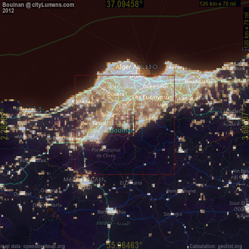
» Earth at Night: Flat Maps 2012, 2016