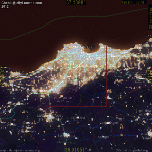
Chebli night lights from space
Night Light of Chebli (Blida) from space (Algeria) Src. Average luminocity for 10x10km area is 62.4139% and for 50x50km: 47.7642%.
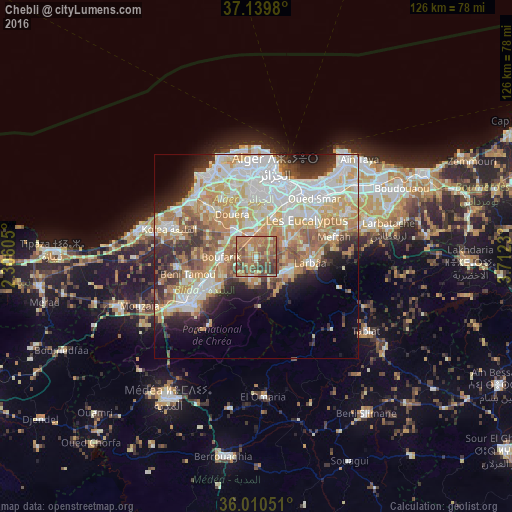
Analysis of Chebli night lights 2016
Square area 10x10 km:
100  0.73%
0.73%
90-99 4.4%
80-89 10.44%
70-79 12.45%
60-69 30.95%
50-59 18.5%
40-49 15.75%
30-39 6.78%
20-29 0%
10-19 0%
0-9 0%
0.73%90-99
4.4%80-89
10.44%70-79
12.45%60-69
30.95%50-59
18.5%40-49
15.75%30-39
6.78%20-29
0%10-19
0%0-9
0%Square area 50x50 km:
100 11.48%
90-99 10.51%
80-89 6.64%
70-79 7.91%
60-69 8.76%
50-59 4.66%
40-49 4.48%
30-39 4.62%
20-29 5.96%
10-19 6.51%
0-9 28.48%
11.48%90-99
10.51%80-89
6.64%70-79
7.91%60-69
8.76%50-59
4.66%40-49
4.48%30-39
4.62%20-29
5.96%10-19
6.51%0-9
28.48%Clear (daylight) street map image can be seen on geolist.org.
Map coordinates:
37° 8' 23.3" North, 2° 18' 21.8" East
36° 34' 38" North, 3° 0' 33" East
36° 0' 37.8" North, 3° 42' 44.3" East
Some cities around Chebli sort by population:
• Baraki
12.6 km =7.8 mi,  37°
37°
• Larbaâ
13 km =8.1 mi,  96°
96°
• Bougara
7.5 km =4.7 mi,  121°
121°
• Boufarik
8.7 km =5.4 mi,  267°
267°
• Sidi Moussa
7.7 km =4.8 mi,  65°
65°
• Souma
11.4 km =7.1 mi,  234°
234°
• Bouinan
5.3 km =3.3 mi,  196°
196°
• Douera
11.8 km =7.3 mi,  330°
330°
2501680 (p: 19,901)
Sources (retrieved 2019-11-25):
» Earth at Night: Flat Maps 2012, 2016