M’Sila night lights from space
Night Light of M’Sila (M'Sila) from space (Algeria) Src. Average luminocity for 10x10km area is 65.7255% and for 50x50km: 10.9871%.
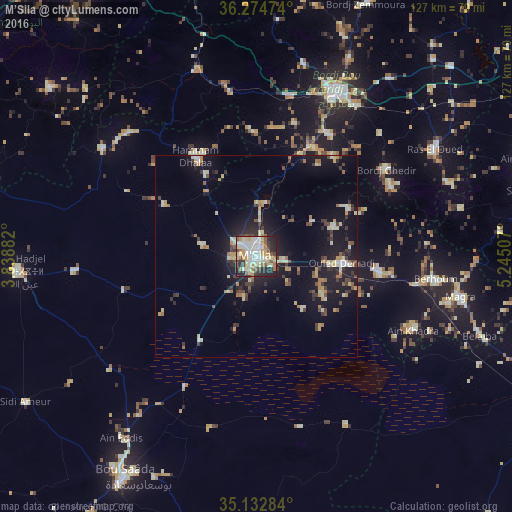
Analysis of M’Sila night lights 2016
Square area 10x10 km:
 14.86%
90-99
18.71%80-89
9.62%70-79
11.71%60-69
5.59%50-59
3.85%40-49
7.52%30-39
6.29%20-29
18.01%10-19
3.85%0-9
0%Square area 50x50 km:
0.92%90-99
1.91%80-89
1.43%70-79
1.53%60-69
1.21%50-59
0.77%40-49
1.39%30-39
2.18%20-29
2.47%10-19
10.34%0-9
75.84%Clear (daylight) street map image can be seen on geolist.org.
Map coordinates:
36° 16' 29.1" North, 3° 50' 19.8" East
35° 42' 21" North, 4° 32' 31" East
35° 7' 58.2" North, 5° 14' 42.3" East
Some cities around M’Sila sort by population:
• Bordj Bou Arreridj
45.4 km =28.2 mi,  25°
25°
• El Achir
40.5 km =25.2 mi,  10°
10°
• Râs el Oued
51.4 km =31.9 mi,  59°
59°
• ‘Aïn el Hadjel
59.8 km =37.2 mi,  266°
266°
• Bordj Ghdir
38.8 km =24.1 mi, 55°
• Melouza
44.2 km =27.5 mi,  313°
313°
• Mansourah
43.2 km =26.8 mi,  349°
349°
• Bordj Zemoura
69.3 km =43.1 mi,  24°
24°
2486690 (p: 100,000)
Sources (retrieved 2019-11-25):
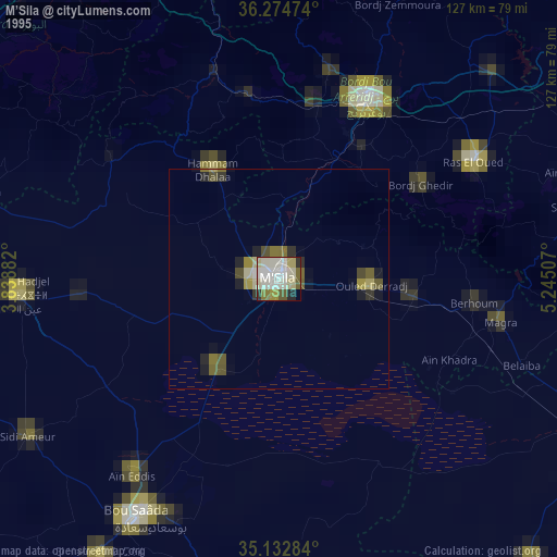
» NASA, Earths city lights 1995
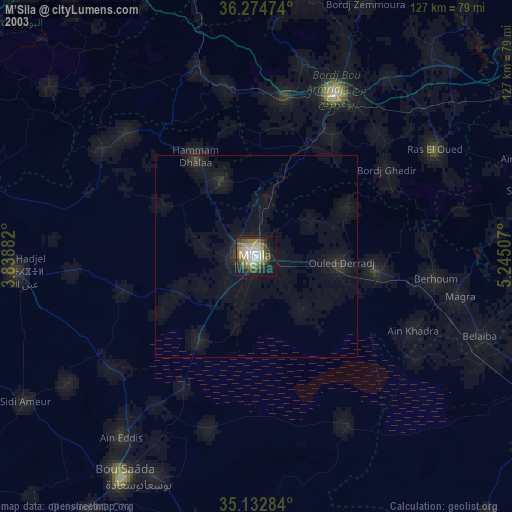
» NASA city lights 2003
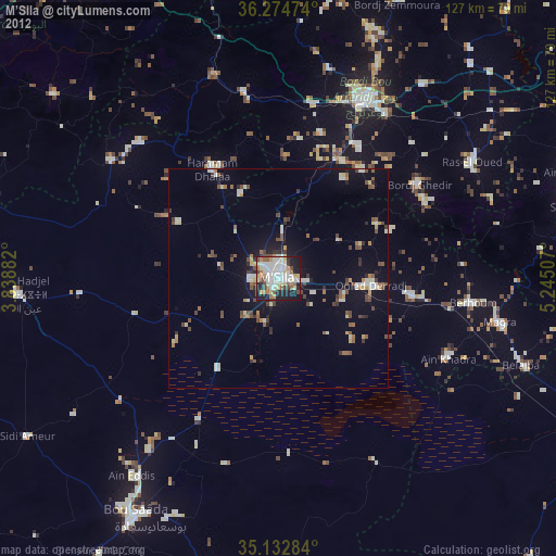
» Earth at Night: Flat Maps 2012, 2016