‘Aïn el Hadjel night lights from space
Night Light of ‘Aïn el Hadjel (M'Sila) from space (Algeria) Src. Average luminocity for 10x10km area is 15.5699% and for 50x50km: 1.6274%.
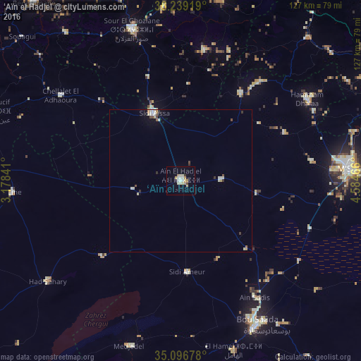
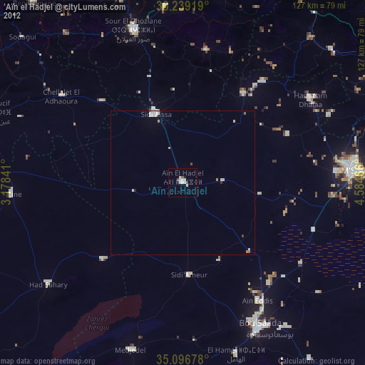
Analysis of ‘Aïn el Hadjel night lights 2016
Square area 10x10 km:
 2.8%
2.8%90-99
2.8%80-89
2.62%70-79
4.37%60-69
0%50-59
0%40-49
0.7%30-39
0.7%20-29
0%10-19
3.85%0-9
82.17%Square area 50x50 km:
0.25%90-99
0.37%80-89
0.23%70-79
0.27%60-69
0.04%50-59
0.06%40-49
0.2%30-39
0.23%20-29
0.04%10-19
0.41%0-9
97.89%Clear (daylight) street map image can be seen on geolist.org.
Map coordinates:
36° 14' 21.1" North, 3° 10' 42.3" East
35° 40' 12.1" North, 3° 52' 53.5" East
35° 5' 48.4" North, 4° 35' 4.8" East
Some cities around ‘Aïn el Hadjel sort by population:
• M’Sila
59.8 km =37.2 mi,  86°
86°
• Sidi Aïssa
25.9 km =16.1 mi,  337°
337°
• Birine
59.4 km =36.9 mi,  266°
266°
• Sour el Ghozlane
55.8 km =34.7 mi, 342°
• Aïn Bessem
71.8 km =44.6 mi, 344°
• Melouza
44.1 km =27.4 mi,  38°
38°
• Mansourah
69.2 km =43 mi,  47°
47°
• ’Aïn Boucif
69.7 km =43.3 mi,  290°
290°
2508157 (p: 42,527)
Sources (retrieved 2019-11-25):
» Earth at Night: Flat Maps 2012, 2016