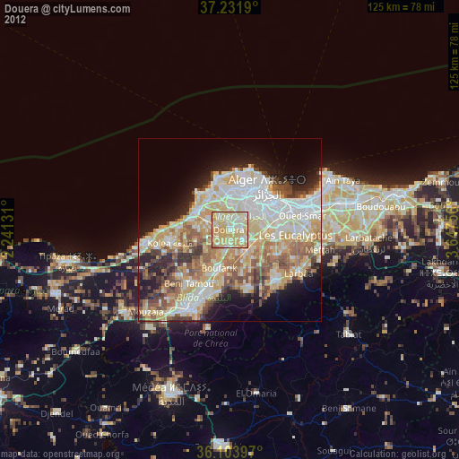
Douera night lights from space
Night Light of Douera (Tipaza) from space (Algeria) Src. Average luminocity for 10x10km area is 82.6136% and for 50x50km: 45.4645%.
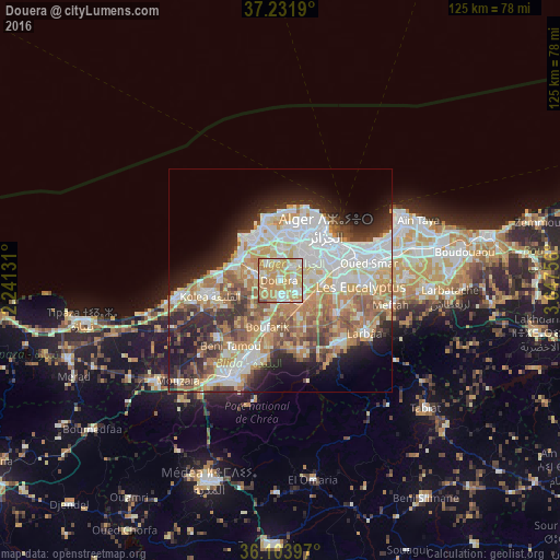
Analysis of Douera night lights 2016
Square area 10x10 km:
100  15.38%
90-99 17.95%
80-89 17.58%
70-79 34.43%
60-69 12.64%
50-59 1.28%
40-49 0.73%
30-39 0%
20-29 0%
10-19 0%
0-9 0%
15.38%90-99
17.95%80-89
17.58%70-79
34.43%60-69
12.64%50-59
1.28%40-49
0.73%30-39
0%20-29
0%10-19
0%0-9
0%Square area 50x50 km:
100 10.6%
90-99 9.69%
80-89 6.07%
70-79 7%
60-69 8.48%
50-59 4.74%
40-49 4.51%
30-39 4.94%
20-29 7.23%
10-19 8.72%
0-9 28.04%
10.6%90-99
9.69%80-89
6.07%70-79
7%60-69
8.48%50-59
4.74%40-49
4.51%30-39
4.94%20-29
7.23%10-19
8.72%0-9
28.04%Clear (daylight) street map image can be seen on geolist.org.
Map coordinates:
37° 13' 54.8" North, 2° 14' 28.7" East
36° 40' 12" North, 2° 56' 40" East
36° 6' 14.3" North, 3° 38' 51.2" East
Some cities around Douera sort by population:
• Algiers
14.5 km =9 mi,  61°
61°
• Baraki
13.5 km =8.4 mi,  91°
91°
• Birkhadem
10.7 km =6.6 mi, 62°
• Boufarik
11 km =6.8 mi,  195°
195°
• Cheraga
10.9 km =6.8 mi,  6°
6°
• Chebli
11.8 km =7.3 mi,  150°
150°
• Zeralda
10.2 km =6.3 mi,  297°
297°
• Saoula
8.1 km =5 mi, 61°
2499193 (p: 26,926)
Sources (retrieved 2019-11-25):
» Earth at Night: Flat Maps 2012, 2016