Souma night lights from space
Night Light of Souma (Blida) from space (Algeria) Src. Average luminocity for 10x10km area is 60.5385% and for 50x50km: 38.9604%.
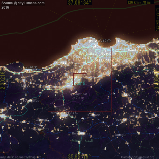
Analysis of Souma night lights 2016
Square area 10x10 km:
100  9.89%
9.89%
90-99 15.02%
80-89 6.78%
70-79 10.99%
60-69 13.92%
50-59 7.88%
40-49 5.49%
30-39 6.04%
20-29 13%
10-19 9.34%
0-9 1.65%
9.89%90-99
15.02%80-89
6.78%70-79
10.99%60-69
13.92%50-59
7.88%40-49
5.49%30-39
6.04%20-29
13%10-19
9.34%0-9
1.65%Square area 50x50 km:
100 7.47%
90-99 7.53%
80-89 5.62%
70-79 6.54%
60-69 8.33%
50-59 4.77%
40-49 3.93%
30-39 4.5%
20-29 6.15%
10-19 9.58%
0-9 35.59%
7.47%90-99
7.53%80-89
5.62%70-79
6.54%60-69
8.33%50-59
4.77%40-49
3.93%30-39
4.5%20-29
6.15%10-19
9.58%0-9
35.59%Clear (daylight) street map image can be seen on geolist.org.
Map coordinates:
37° 4' 52.8" North, 2° 12' 7.8" East
36° 31' 6" North, 2° 54' 19" East
35° 57' 4.3" North, 3° 36' 30.3" East
Some cities around Souma sort by population:
• Blida
8.8 km =5.5 mi,  232°
232°
• Beni Mered
4 km =2.5 mi,  278°
278°
• Bougara
15.9 km =9.9 mi,  80°
80°
• Boufarik
6.2 km =3.9 mi,  5°
5°
• Boû Arfa
10.2 km =6.3 mi, 232°
• Bouinan
7.9 km =4.9 mi, 79°
• Oued el Alleug
11.1 km =6.9 mi,  291°
291°
• Chebli
11.4 km =7.1 mi,  54°
54°
2479183 (p: 40,745)
Sources (retrieved 2019-11-25):
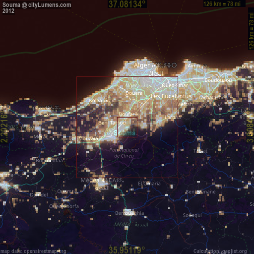
» Earth at Night: Flat Maps 2012, 2016