Beni Mered night lights from space
Night Light of Beni Mered (Blida) from space (Algeria) Src. Average luminocity for 10x10km area is 78.9505% and for 50x50km: 37.413%.
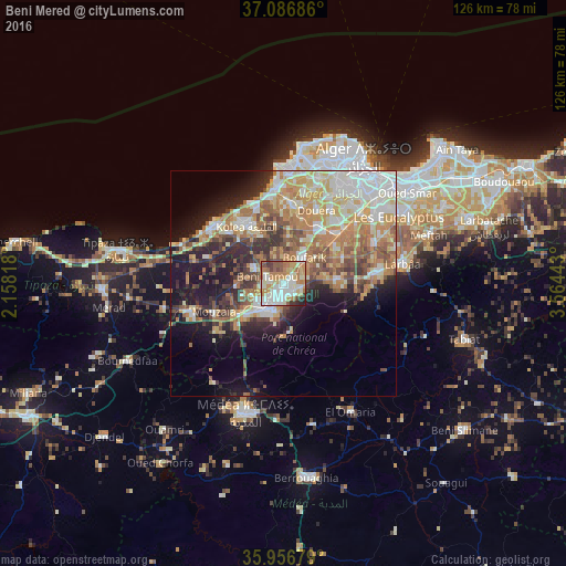
Analysis of Beni Mered night lights 2016
Square area 10x10 km:
 20.15%
90-99
24.18%80-89
9.34%70-79
13.37%60-69
15.93%50-59
6.78%40-49
3.48%30-39
4.21%20-29
2.56%10-19
0%0-9
0%Square area 50x50 km:
6.72%90-99
7.12%80-89
5.38%70-79
6.27%60-69
8.09%50-59
4.44%40-49
3.93%30-39
4.58%20-29
6.25%10-19
11.49%0-9
35.74%Clear (daylight) street map image can be seen on geolist.org.
Map coordinates:
37° 5' 12.7" North, 2° 9' 29.4" East
36° 31' 26" North, 2° 51' 40.7" East
35° 57' 24.4" North, 3° 33' 51.9" East
Some cities around Beni Mered sort by population:
• Blida
6.7 km =4.2 mi,  206°
206°
• Boufarik
7.2 km =4.5 mi,  39°
39°
• Boû Arfa
8 km =5 mi, 211°
• Souma
4 km =2.5 mi,  98°
98°
• Bouinan
11.7 km =7.3 mi,  85°
85°
• Chiffa
12.9 km =8 mi,  238°
238°
• Oued el Alleug
7.2 km =4.5 mi,  298°
298°
• Chebli
14.5 km =9 mi,  65°
65°
2504622 (p: 92,749)
Sources (retrieved 2019-11-25):
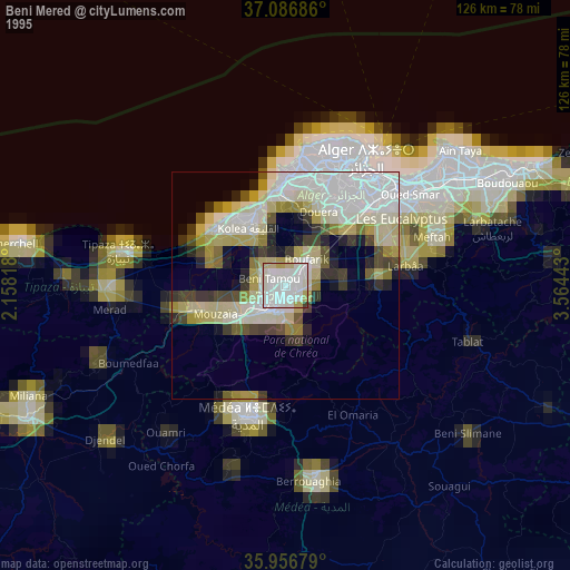
» NASA, Earths city lights 1995
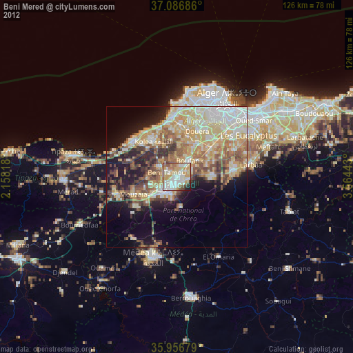
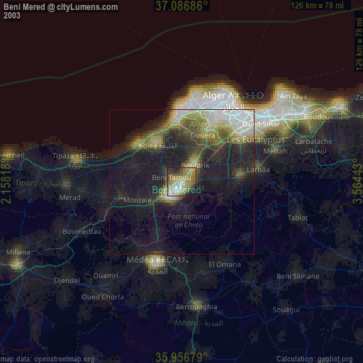
» NASA city lights 2003
» Earth at Night: Flat Maps 2012, 2016