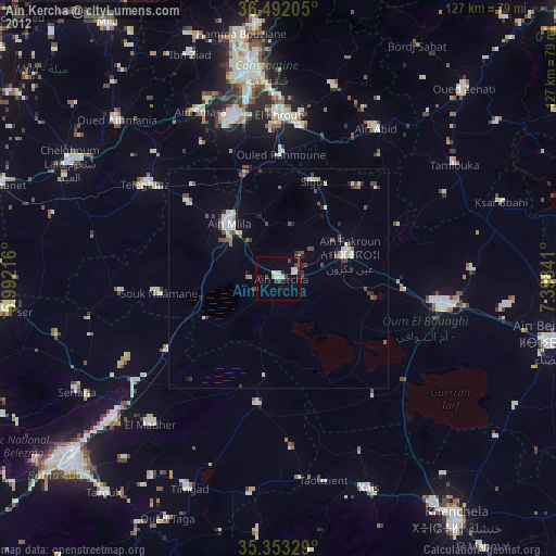
Aïn Kercha night lights from space
Night Light of Aïn Kercha (Oum el Bouaghi) from space (Algeria) Src. Average luminocity for 10x10km area is 13.6209% and for 50x50km: 3.8908%.
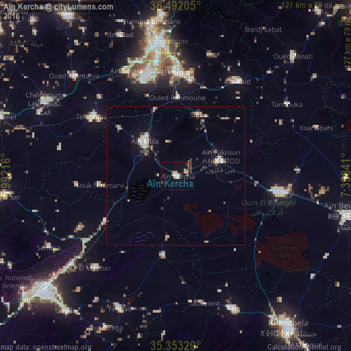
Analysis of Aïn Kercha night lights 2016
Square area 10x10 km:
 1.47%
1.47%90-99
2.2%80-89
1.1%70-79
3.3%60-69
1.28%50-59
0.73%40-49
3.48%30-39
0.92%20-29
0.37%10-19
3.3%0-9
81.87%Square area 50x50 km:
0.31%90-99
0.77%80-89
0.33%70-79
0.57%60-69
0.31%50-59
0.24%40-49
0.71%30-39
0.8%20-29
0.65%10-19
1.67%0-9
93.65%Clear (daylight) street map image can be seen on geolist.org.
Map coordinates:
36° 29' 31.4" North, 5° 59' 31.8" East
35° 55' 29" North, 6° 41' 43" East
35° 21' 11.8" North, 7° 23' 54.3" East
Some cities around Aïn Kercha sort by population:
• Constantine
49.5 km =30.8 mi,  351°
351°
• Oum el Bouaghi
38.1 km =23.7 mi,  98°
98°
• El Khroub
37.7 km =23.4 mi,  359°
359°
• Chelghoum el Aïd
54.4 km =33.8 mi,  299°
299°
• Aïn Fakroun
16.9 km =10.5 mi,  72°
72°
• Telerghma
37.3 km =23.2 mi, 304°
• ’Aïn Abid
40.8 km =25.4 mi,  33°
33°
• Aïn Smara
41.9 km =26 mi,  335°
335°
2508059 (p: 32,497)
Sources (retrieved 2019-11-25):
» Earth at Night: Flat Maps 2012, 2016