Oum el Bouaghi night lights from space
Night Light of Oum el Bouaghi from space (Algeria) Src. Average luminocity for 10x10km area is 31.9139% and for 50x50km: 4.112%.
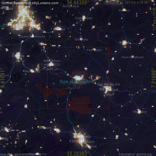
Analysis of Oum el Bouaghi night lights 2016
Square area 10x10 km:
 6.78%
6.78%90-99
6.59%80-89
4.76%70-79
4.58%60-69
0.73%50-59
1.83%40-49
1.83%30-39
2.01%20-29
5.31%10-19
41.58%0-9
23.99%Square area 50x50 km:
0.52%90-99
0.79%80-89
0.55%70-79
0.45%60-69
0.25%50-59
0.34%40-49
0.55%30-39
0.5%20-29
0.6%10-19
2.73%0-9
92.72%Clear (daylight) street map image can be seen on geolist.org.
Map coordinates:
36° 26' 35.1" North, 6° 24' 37.5" East
35° 52' 31.5" North, 7° 6' 48.7" East
35° 18' 13.1" North, 7° 48' 60" East
Some cities around Oum el Bouaghi sort by population:
• Khenchela
49 km =30.4 mi,  176°
176°
• Aïn Beïda
26.7 km =16.6 mi,  109°
109°
• El Khroub
57.3 km =35.6 mi,  318°
318°
• Aïn Fakroun
24.1 km =15 mi,  296°
296°
• Sedrata
47.1 km =29.3 mi,  53°
53°
• Aïn Kercha
38.1 km =23.7 mi,  278°
278°
• Meskiana
56.8 km =35.3 mi,  118°
118°
• ’Aïn Abid
42.5 km =26.4 mi,  338°
338°
2484620 (p: 100,821)
Sources (retrieved 2019-11-25):
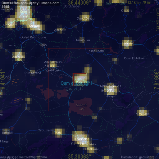
» NASA, Earths city lights 1995
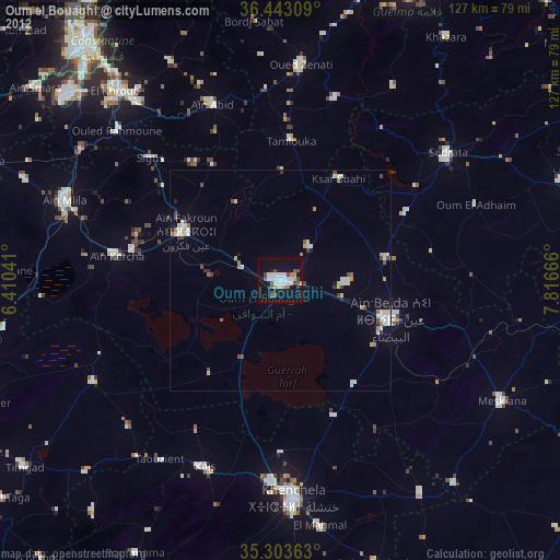
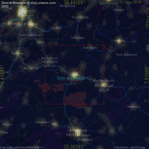
» NASA city lights 2003
» Earth at Night: Flat Maps 2012, 2016