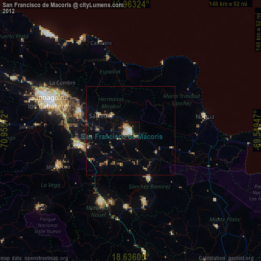
San Francisco de Macorís night lights from space
Night Light of San Francisco de Macorís (Duarte) from space (Dominican Republic) Src. Average luminocity for 10x10km area is 48.3398% and for 50x50km: 6.6579%.

Analysis of San Francisco de Macorís night lights 2016
Square area 10x10 km:
 8.23%
8.23%90-99
13.42%80-89
10.61%70-79
2.6%60-69
3.46%50-59
5.84%40-49
3.9%30-39
4.33%20-29
12.12%10-19
30.95%0-9
4.55%Square area 50x50 km:
0.35%90-99
0.75%80-89
0.74%70-79
0.58%60-69
0.85%50-59
0.69%40-49
0.99%30-39
1.61%20-29
2.28%10-19
5.78%0-9
85.39%Clear (daylight) street map image can be seen on geolist.org.
Map coordinates:
19° 57' 47.7" North, 70° 57' 20.6" West
19° 18' 3.6" North, 70° 15' 9.3" West
18° 38' 9.8" North, 69° 32' 58.1" West
Some cities around San Francisco de Macorís sort by population:
• Salcedo
19.3 km =12 mi,  296°
296°
• Salsipuedes
17.7 km =11 mi,  311°
311°
• Fantino
20.6 km =12.8 mi,  193°
193°
• Las Guáranas
12.9 km =8 mi,  158°
158°
• Pimentel
19.9 km =12.4 mi,  130°
130°
• Tenares
13.2 km =8.2 mi, 308°
• Castillo
25.8 km =16 mi,  113°
113°
• Jima Abajo
22.7 km =14.1 mi,  214°
214°
3493146 (p: 124,763)
Sources (retrieved 2019-11-25):
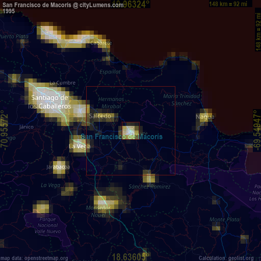
» NASA, Earths city lights 1995
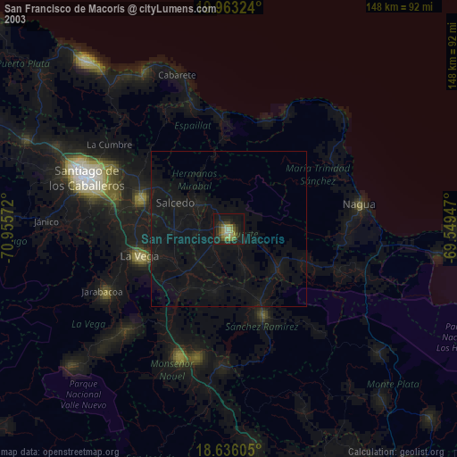
» NASA city lights 2003
» Earth at Night: Flat Maps 2012, 2016